Santiago Plan
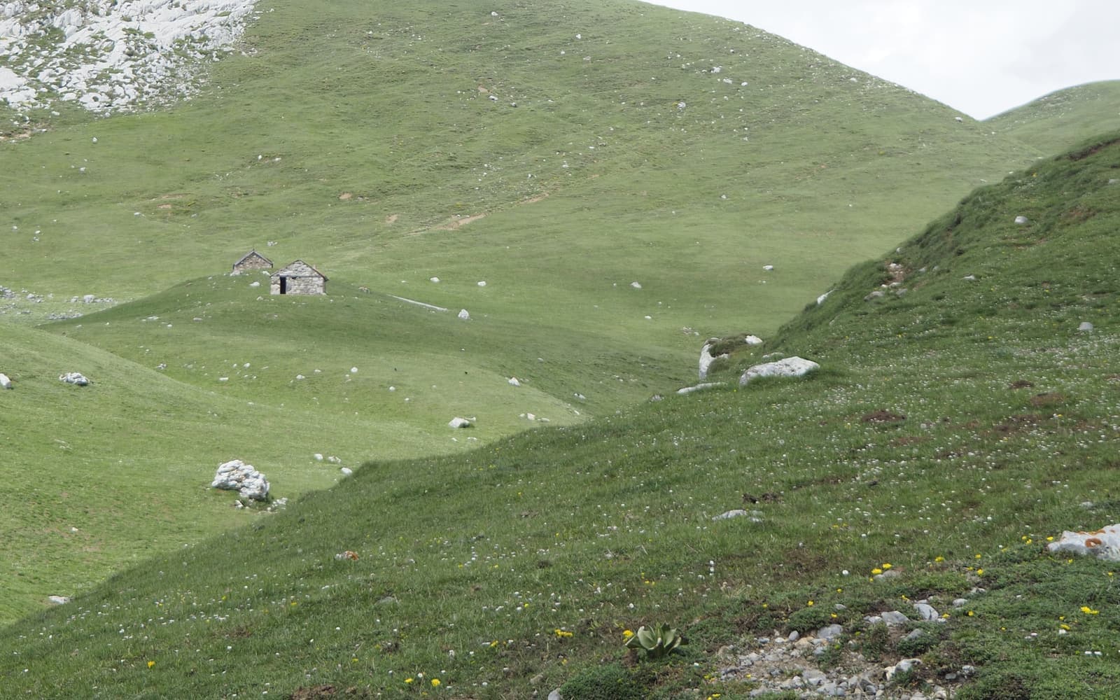
Landscape of the Vía de la Plata
© José Manuel Guerrero · Fotografía propia · © Todos los derechos reservados

Vía de la Plata

The great southern route: from Sevilla, through Extremadura and Castilla, then the Camino Sanabrés all the way to Santiago. The longest and most solitary of them all.

Historic
Distance
≈ 1.000 (Sevilla–Sanabrés) km
Days
38–45
Difficulty
Hard
Terrain
Dehesa, plains and mountains

Elevation profile

Ascent

+11961 m

Descent

11718 m

-25586019740 km249 km498 km747 km995 km

The Vía de la Plata follows an ancient Roman road north from Sevilla. It is the longest and one of the loneliest routes, with long stages across the dehesa, monumental cities (Mérida, Cáceres, Salamanca, Zamora) and few fellow pilgrims.

At Granja de Moreruela (Zamora) the way forks: those bound for Santiago usually take the Camino Sanabrés, which crosses Sanabria and enters Galicia through Ourense on its way to the Obradoiro. It is this Sevilla–Sanabrés itinerary that we document here.

Who it's for

For seasoned pilgrims seeking a great crossing in solitude.

The itinerary

Stages of the route

Classic division into stages. Distances are approximate and for guidance; each pilgrim adjusts their days to their own pace.

  1. 0122 km

    Cumulative: 22 km

    6268 m5 h 20 min

    Andalusia (Sevilla)

    Sevilla → Guillena

    Setting out from Seville Cathedral, across the Guadalquivir floodplain to Guillena.

    View stage
  2. 0218 km

    Cumulative: 40 km

    35438 m4 h 53 min

    Andalusia (Sevilla)

    Guillena → Castilblanco de los Arroyos

    A gentle climb toward the Sierra Norte of Seville.

    View stage
  3. 0329 km

    Cumulative: 69 km

    449330 m7 h 39 min

    Andalusia (Sevilla)

    Castilblanco de los Arroyos → Almadén de la Plata

    The Sierra Norte Natural Park, through rolling holm-oak pastureland.

    View stage
  4. 0415 km

    Cumulative: 84 km

    192168 m3 h 53 min

    Andalusia (Sevilla)

    Almadén de la Plata → El Real de la Jara

    Dehesa meadows and grazing livestock all the way to El Real de la Jara.

    View stage
  5. 0521 km

    Cumulative: 105 km

    34771 m5 h 35 min

    Extremadura (Badajoz)

    El Real de la Jara → Monesterio

    Crossing into Extremadura, through the homeland of Iberian ham.

    View stage
  6. 0621 km

    Cumulative: 126 km

    175342 m5 h 18 min

    Extremadura (Badajoz)

    Monesterio → Fuente de Cantos

    A Roman road winding among holm oaks to Fuente de Cantos.

    View stage
  7. 0725 km

    Cumulative: 151 km

    110180 m6 h 8 min

    Extremadura (Badajoz)

    Fuente de Cantos → Zafra

    Puebla de Sancho Pérez and the stately town of Zafra.

    View stage
  8. 0819 km

    Cumulative: 170 km

    171272 m4 h 49 min

    Extremadura (Badajoz)

    Zafra → Villafranca de los Barros

    Los Santos de Maimona and vineyards leading on to Villafranca.

    View stage
  9. 0927 km

    Cumulative: 197 km

    56163 m6 h 31 min

    Extremadura (Badajoz)

    Villafranca de los Barros → Torremejía

    A long straight run through the vineyards of Tierra de Barros.

    View stage
  10. 1018 km

    Cumulative: 215 km

    93168 m4 h 26 min

    Extremadura (Badajoz)

    Torremejía → Mérida

    Mérida and its extraordinary wealth of Roman monuments.

    View stage
  11. 1140 km

    Cumulative: 255 km

    455202 m10 h 17 min

    Extremadura (Cáceres)

    Mérida → Alcuéscar

    The Proserpina reservoir and an old Roman road; a long stage.

    View stage
  12. 1219 km

    Cumulative: 274 km

    142185 m4 h 46 min

    Extremadura (Cáceres)

    Alcuéscar → Aldea del Cano

    Extremaduran dehesa all the way to Aldea del Cano.

    View stage
  13. 1326 km

    Cumulative: 300 km

    256260 m6 h 37 min

    Extremadura (Cáceres)

    Aldea del Cano → Cáceres

    Arrival in Cáceres, its old quarter a World Heritage Site.

    View stage
  14. 1443 km

    Cumulative: 343 km

    279370 m10 h 42 min

    Extremadura (Cáceres)

    Cáceres → Cañaveral

    Casar de Cáceres and the reservoir on the way to Cañaveral.

    View stage
  15. 1528 km

    Cumulative: 371 km

    313357 m7 h 11 min

    Extremadura (Cáceres)

    Cañaveral → Galisteo

    Grimaldo and the walled town of Galisteo.

    View stage
  16. 1612 km

    Cumulative: 383 km

    9895 m3 h 1 min

    Extremadura (Cáceres)

    Galisteo → Carcaboso

    A short stage alongside the River Jerte.

    View stage
  17. 1740 km

    Cumulative: 423 km

    339127 m10 h 5 min

    Extremadura (Cáceres)

    Carcaboso → Aldeanueva del Camino

    The Roman arch of Cáparra; a very long and solitary stage.

    View stage
  18. 1823 km

    Cumulative: 446 km

    615341 m6 h 30 min

    Castile and León (Salamanca)

    Aldeanueva del Camino → La Calzada de Béjar

    Crossing into Castile and León up the valley.

    View stage
  19. 1920 km

    Cumulative: 466 km

    259101 m5 h 12 min

    Castile and León (Salamanca)

    La Calzada de Béjar → Fuenterroble de Salvatierra

    A beautifully preserved Roman road to Fuenterroble.

    View stage
  20. 2028 km

    Cumulative: 494 km

    321296 m7 h 12 min

    Castile and León (Salamanca)

    Fuenterroble de Salvatierra → San Pedro de Rozados

    The Pico de la Dueña, the highest point on this section.

    View stage
  21. 2124 km

    Cumulative: 518 km

    185356 m6 h 1 min

    Castile and León (Salamanca)

    San Pedro de Rozados → Salamanca

    Arrival in Salamanca and its magnificent Plaza Mayor.

    View stage
  22. 2237 km

    Cumulative: 555 km

    224190 m9 h 11 min

    Castile and León (Zamora)

    Salamanca → El Cubo de la Tierra del Vino

    The Calzada de Valdunciel; long and flat.

    View stage
  23. 2333 km

    Cumulative: 588 km

    160339 m8 h 7 min

    Castile and León (Zamora)

    El Cubo de la Tierra del Vino → Zamora

    Villanueva de Campeán on the way to Romanesque Zamora.

    View stage
  24. 2418 km

    Cumulative: 606 km

    11977 m4 h 29 min

    Castile and León (Zamora)

    Zamora → Montamarta

    The Ricobayo reservoir comes into view beside Montamarta.

    View stage
  25. 2522 km

    Cumulative: 628 km

    115112 m5 h 26 min

    Castile and León (Zamora)

    Montamarta → Granja de Moreruela

    At Granja de Moreruela the Vía splits toward Astorga and the Camino Sanabrés heads to Ourense; we take the Sanabrés.

    View stage
  26. 2618 km

    Cumulative: 646 km

    154155 m4 h 33 min

    Castile and León (Zamora)

    Granja de Moreruela → Tábara

    The Camino Sanabrés begins, bound for Galicia.

    View stage
  27. 2723 km

    Cumulative: 669 km

    201150 m5 h 49 min

    Castile and León (Zamora)

    Tábara → Santa Croya de Tera

    Santa Marta de Tera and its Jacobean Romanesque church.

    View stage
  28. 2828 km

    Cumulative: 697 km

    178117 m6 h 58 min

    Castile and León (Zamora)

    Santa Croya de Tera → Rionegro del Puente

    The Tera valley all the way to Rionegro del Puente.

    View stage
  29. 299 km

    Cumulative: 706 km

    17988 m2 h 26 min

    Castile and León (Zamora)

    Rionegro del Puente → Mombuey

    Into the country of Sanabria as far as Mombuey.

    View stage
  30. 3029 km

    Cumulative: 735 km

    243243 m7 h 19 min

    Castile and León (Zamora)

    Mombuey → Puebla de Sanabria

    A long stage to the medieval town of Puebla de Sanabria.

    View stage
  31. 3131 km

    Cumulative: 766 km

    865704 m8 h 49 min

    Castile and León (Zamora)

    Puebla de Sanabria → Lubián

    The Sierra de la Culebra and the climb toward the gateway of Galicia.

    View stage
  32. 3235 km

    Cumulative: 801 km

    835922 m9 h 43 min

    Galicia (Ourense)

    Lubián → A Gudiña

    The A Canda pass: your first steps into Galicia.

    View stage
  33. 3333 km

    Cumulative: 834 km

    5431055 m8 h 46 min

    Galicia (Ourense)

    A Gudiña → Laza

    The Campobecerros variant; a hard and very solitary stage.

    View stage
  34. 3433 km

    Cumulative: 867 km

    604526 m8 h 52 min

    Galicia (Ourense)

    Laza → Xunqueira de Ambía

    Alberguería, with its scallop shells, on the way to Xunqueira de Ambía.

    View stage
  35. 3524 km

    Cumulative: 891 km

    169591 m6 h

    Galicia (Ourense)

    Xunqueira de Ambía → Ourense

    Ourense, its bridges and its thermal springs.

    View stage
  36. 3623 km

    Cumulative: 914 km

    596322 m6 h 28 min

    Galicia (Ourense)

    Ourense → Cea

    San Cristovo de Cea, renowned for its bread.

    View stage
  37. 3716 km

    Cumulative: 930 km

    364199 m4 h 25 min

    Galicia (Ourense)

    Cea → Castro Dozón

    The monastery of Oseira (variant) and Dozón.

    View stage
  38. 3828 km

    Cumulative: 958 km

    437510 m7 h 24 min

    Galicia (Pontevedra)

    Castro Dozón → Silleda

    A Laxe and open countryside all the way to Silleda.

    View stage
  39. 3920 km

    Cumulative: 978 km

    160586 m5 h 2 min

    Galicia (Pontevedra · A Coruña)

    Silleda → Ponte Ulla

    Bandeira and the Ulla valley down to Ponte Ulla.

    View stage
  40. 4022 km

    Cumulative: 1000 km

    544342 m6 h 9 min

    Galicia (A Coruña)

    Ponte Ulla → Santiago de Compostela

    The final stage to the Praza do Obradoiro.

    View stage

Plan your daily stages

Choose which stage you start from, how many days you have and at what pace; we split the stages into days balanced by effort (distance and elevation). You can save, share or print your plan.

Pace

40 days · ≈ 1000 km in total

This split is not realistic on foot: at least one day goes over 42 effort units (kilometres plus climb). Add days or start closer to Santiago (from Sarria, for instance, if you have less than a week).

  1. Day 1Stage 1
    SevillaGuillenaView stage 1
    ≈ 22 km+62 m
  2. Day 2Stage 2
    GuillenaCastilblanco de los ArroyosView stage 2
    ≈ 18 km+354 m
  3. Day 3Stage 3
    Castilblanco de los ArroyosAlmadén de la PlataView stage 3
    ≈ 29 km+449 mDemanding day
  4. Day 4Stage 4
    Almadén de la PlataEl Real de la JaraView stage 4
    ≈ 15 km+192 m
  5. Day 5Stage 5
    El Real de la JaraMonesterioView stage 5
    ≈ 21 km+347 m
  6. Day 6Stage 6
    MonesterioFuente de CantosView stage 6
    ≈ 21 km+175 m
  7. Day 7Stage 7
    Fuente de CantosZafraView stage 7
    ≈ 25 km+110 m
  8. Day 8Stage 8
    ZafraVillafranca de los BarrosView stage 8
    ≈ 19 km+171 m
  9. Day 9Stage 9
    Villafranca de los BarrosTorremejíaView stage 9
    ≈ 27 km+56 m
  10. Day 10Stage 10
    TorremejíaMéridaView stage 10
    ≈ 18 km+93 m
  11. Day 11Stage 11
    MéridaAlcuéscarView stage 11
    ≈ 40 km+455 mNot advisable
  12. Day 12Stage 12
    AlcuéscarAldea del CanoView stage 12
    ≈ 19 km+142 m
  13. Day 13Stage 13
    Aldea del CanoCáceresView stage 13
    ≈ 26 km+256 m
  14. Day 14Stage 14
    CáceresCañaveralView stage 14
    ≈ 43 km+279 mNot advisable
  15. Day 15Stage 15
    CañaveralGalisteoView stage 15
    ≈ 28 km+313 m
  16. Day 16Stage 16
    GalisteoCarcabosoView stage 16
    ≈ 12 km+98 m
  17. Day 17Stage 17
    CarcabosoAldeanueva del CaminoView stage 17
    ≈ 40 km+339 mNot advisable
  18. Day 18Stage 18
    Aldeanueva del CaminoLa Calzada de BéjarView stage 18
    ≈ 23 km+615 m
  19. Day 19Stage 19
    La Calzada de BéjarFuenterroble de SalvatierraView stage 19
    ≈ 20 km+259 m
  20. Day 20Stage 20
    Fuenterroble de SalvatierraSan Pedro de RozadosView stage 20
    ≈ 28 km+321 m
  21. Day 21Stage 21
    San Pedro de RozadosSalamancaView stage 21
    ≈ 24 km+185 m
  22. Day 22Stage 22
    SalamancaEl Cubo de la Tierra del VinoView stage 22
    ≈ 37 km+224 mDemanding day
  23. Day 23Stage 23
    El Cubo de la Tierra del VinoZamoraView stage 23
    ≈ 33 km+160 mDemanding day
  24. Day 24Stage 24
    ZamoraMontamartaView stage 24
    ≈ 18 km+119 m
  25. Day 25Stage 25
    MontamartaGranja de MoreruelaView stage 25
    ≈ 22 km+115 m
  26. Day 26Stage 26
    Granja de MoreruelaTábaraView stage 26
    ≈ 18 km+154 m
  27. Day 27Stage 27
    TábaraSanta Croya de TeraView stage 27
    ≈ 23 km+201 m
  28. Day 28Stage 28
    Santa Croya de TeraRionegro del PuenteView stage 28
    ≈ 28 km+178 m
  29. Day 29Stage 29
    Rionegro del PuenteMombueyView stage 29
    ≈ 9 km+179 m
  30. Day 30Stage 30
    MombueyPuebla de SanabriaView stage 30
    ≈ 29 km+243 m
  31. Day 31Stage 31
    Puebla de SanabriaLubiánView stage 31
    ≈ 31 km+865 mDemanding day
  32. Day 32Stage 32
    LubiánA GudiñaView stage 32
    ≈ 35 km+835 mNot advisable
  33. Day 33Stage 33
    A GudiñaLazaView stage 33
    ≈ 33 km+543 mDemanding day
  34. Day 34Stage 34
    LazaXunqueira de AmbíaView stage 34
    ≈ 33 km+604 mDemanding day
  35. Day 35Stage 35
    Xunqueira de AmbíaOurenseView stage 35
    ≈ 24 km+169 m
  36. Day 36Stage 36
    OurenseCeaView stage 36
    ≈ 23 km+596 m
  37. Day 37Stage 37
    CeaCastro DozónView stage 37
    ≈ 16 km+364 m
  38. Day 38Stage 38
    Castro DozónSilledaView stage 38
    ≈ 28 km+437 mDemanding day
  39. Day 39Stage 39
    SilledaPonte UllaView stage 39
    ≈ 20 km+160 m
  40. Day 40Stage 40
    Ponte UllaSantiago de CompostelaView stage 40
    ≈ 22 km+544 m

An indicative split by effort (distance + elevation). It does not guarantee accommodation at each stop: check each stage and its hostels before finalising your plan.

Add stamps to your digital credential

Save this route to your account, mark each stage you complete and earn your virtual Compostela when you reach Santiago. Free.

The stamps and the digital credential are a keepsake from Santiago Plan, with no official validity: they are not the pilgrim credential and do not replace the physical stamps collected at hostels and churches to obtain the Compostela at the Cathedral.

🛡 Travel insurance for the Camino

Insurance with medical assistance, baggage cover and cancellation protects you against the unexpected: an injury, a mishap or a stage you can't walk. IATI specialises in travel and offers cover valid for the Camino de Santiago.

See IATI insurance

Affiliate link: taking it out through it costs you no more and helps keep this guide independent.

The route

The route

Approximate track of the route with the towns it passes through.

Layers

Use two fingers to move the map; Ctrl + scroll to zoom.

Download and offline navigation

Download the GPX track and open it in your hiking app (OsmAnd, Wikiloc, Locus…) to navigate without coverage.

Download GPX

Where to sleep

Accommodation and services, stage by stage

A selection of pilgrim hostels (albergues) along the Camino, ordered from the start towards Santiago. The municipal and parish ones are usually the cheapest and many cannot be booked (you arrive and check in in order). Confirm beds, price and opening times before relying on them.

2. Castilblanco de los Arroyos

Guillena → Castilblanco de los Arroyos

Hotels and guesthouses
3. Almadén de la Plata

Castilblanco de los Arroyos → Almadén de la Plata

Hotels and guesthouses
4. El Real de la Jara

Almadén de la Plata → El Real de la Jara

Hotels and guesthouses
5. Monesterio

El Real de la Jara → Monesterio

Hotels and guesthouses
6. Fuente de Cantos

Monesterio → Fuente de Cantos

Hotels and guesthouses
7. Zafra

Fuente de Cantos → Zafra

Hotels and guesthouses
17. Aldeanueva del Camino

Carcaboso → Aldeanueva del Camino

Hotels and guesthouses
18. La Calzada de Béjar

Aldeanueva del Camino → La Calzada de Béjar

Hotels and guesthouses
19. Fuenterroble de Salvatierra

La Calzada de Béjar → Fuenterroble de Salvatierra

Hotels and guesthouses
20. San Pedro de Rozados

Fuenterroble de Salvatierra → San Pedro de Rozados

Hotels and guesthouses
21. Salamanca

San Pedro de Rozados → Salamanca

Hotels and guesthouses
22. El Cubo de la Tierra del Vino

Salamanca → El Cubo de la Tierra del Vino

Hotels and guesthouses
23. Zamora

El Cubo de la Tierra del Vino → Zamora

Hotels and guesthouses
26. Tábara

Granja de Moreruela → Tábara

Hotels and guesthouses
31. Lubián

Puebla de Sanabria → Lubián

Hotels and guesthouses
35. Ourense

Xunqueira de Ambía → Ourense

Hotels and guesthouses
40. Santiago de Compostela

Ponte Ulla → Santiago de Compostela

Hotels and guesthouses

Hostel data © OpenStreetMap contributors (ODbL). It does not include beds or price, which are not always in the source; check with the hostel. Is one missing or wrong? Write to us.

Accommodation

Hotels and guesthouses

On the Camino, pilgrim hostels (municipal, parish and private) are the cheapest option, and many cannot be booked: you arrive and check in in order of arrival. The links below search for hotels and guesthouses, for those who prefer to secure a bed in advance.

Affiliate links to Booking.com: booking through them costs you no more and helps keep this independent guide running.

When you reach Santiago

Experiences and guided tours in Santiago

When you finish your Camino, make the most of Santiago: a guided tour of the cathedral and the botafumeiro, a trip to Finisterre and Muxía (the end of the world), or the corners of the old town.

See experiences in Santiago

Affiliate link to GetYourGuide: booking through it costs you no more and helps keep this guide running.

🧭 How to get there

Find out how to travel from your city to Sevilla by train, bus, car or plane.

Open in Google MapsLinks to external planners; schedules and prices on their website.

Camino taxis and transfers

Companies specialising in pilgrims that cover this route: transfers between stages, luggage transport and airport.

Frequently asked questions

How many kilometres is the Vía de la Plata?
The Vía de la Plata is about 1000 km and usually takes around 38–45 days on foot.
Is the Vía de la Plata hard?
Its difficulty is hard. On Santiago Plan you have every stage with a map, elevation profile and hostels, so you can prepare it calmly.
How much does it cost to walk the Vía de la Plata?
Staying in hostels, budget roughly between 950 and 2030 € in total (around 38–45 days), including bed, food and the odd extra. It varies with the season and your travel style.
Do you need to book the hostels?
In low season it's usually not necessary, but in summer and during a Holy Year it's wise to plan ahead and, in many cases, book your accommodation. We can't guarantee bed availability.

Xacobeo 2027

Planning the Vía de la Plata?

Leave your email and we will send you news, tips and deals to prepare this route in good time. No spam.

Start from a city

Other routes

See all