Santiago Plan
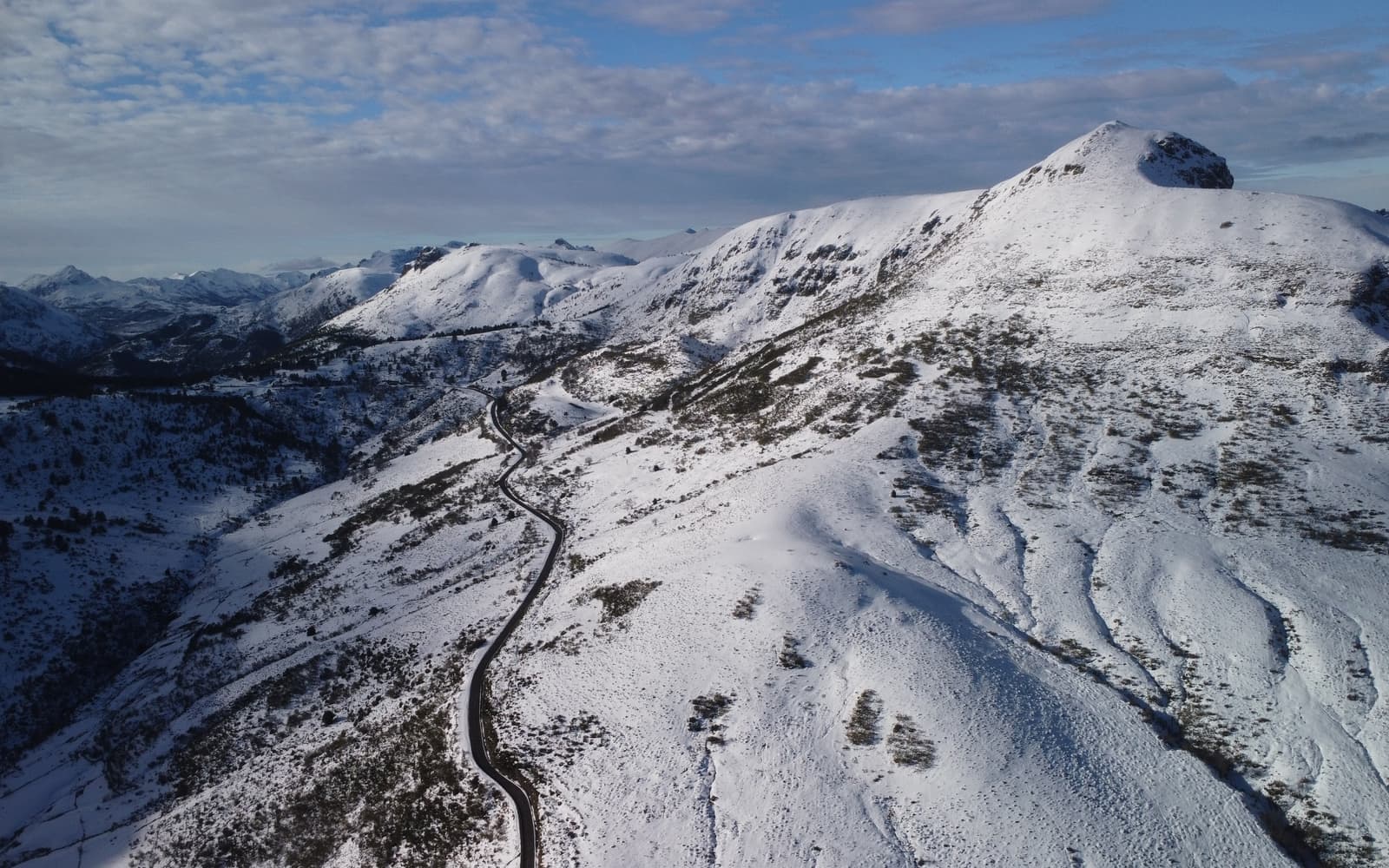
Landscape along the Camino Francés
© José Manuel Guerrero · Fotografía propia · © Todos los derechos reservados

La ruta jacobea por excelencia

Camino Francés

The most historic and well-travelled Camino: from Saint-Jean-Pied-de-Port to Santiago, crossing the Pyrenees, the Meseta and the mountains of Galicia.

Historic
Distance
≈ 764 km
Days
31–34
Difficulty
Moderate
Terrain
Mountains, footpaths, dirt tracks and the odd stretch of tarmac

Elevation profile

Ascent

+11064 m

Descent

10977 m

-2384817190 km194 km387 km581 km775 km

The Camino Francés is the most famous of all the routes to Santiago: the one walked by nearly half of all pilgrims and where the great medieval branches of Europe come together. It sets off from Saint-Jean-Pied-de-Port, crosses the Pyrenees to Roncesvalles and makes its way through Navarre, La Rioja, Castile and León and Galicia, all the way to the Praza do Obradoiro.

Along its roughly 764 km it strings together one unforgettable landmark after another: Pamplona, Puente la Reina, Logroño, the cathedral of Burgos, the Castilian Meseta, León, Astorga, the Cruz de Ferro, O Cebreiro and, from Sarria on, the final 100 km that earn you the Compostela.

Who it's for

Ideal for first-timers thanks to its waymarking, services and pilgrim atmosphere; walked on foot or ridden by bicycle.

The itinerary

Stages of the route

Classic division into stages. Distances are approximate and for guidance; each pilgrim adjusts their days to their own pace.

  1. 0124 km

    Cumulative: 24 km

    970200 m7 h 20 min

    Pyrenees

    Saint-Jean-Pied-de-Port → Roncesvalles

    The queen stage: you cross the Pyrenees over the Puerto de Lepoeder (~1,430 m) to the collegiate church of Roncesvalles. Tough and spectacular; the Napoléon route closes in winter (alternative via Valcarlos).

    View stage
  2. 0221 km

    Cumulative: 45 km

    276701 m5 h 28 min

    Navarre

    Roncesvalles → Zubiri

    A descent through Navarrese beech woods and over the Mezkíritz pass to the medieval bridge of Zubiri.

    View stage
  3. 0321 km

    Cumulative: 66 km

    242312 m5 h 24 min

    Navarre

    Zubiri → Pamplona

    Following the river Arga until you enter Pamplona through its historic old town and its cathedral.

    View stage
  4. 0424 km

    Cumulative: 90 km

    601710 m6 h 43 min

    Navarre

    Pamplona → Puente la Reina

    The Alto del Perdón, with its silhouettes of pilgrims, and the beautiful Romanesque bridge of Puente la Reina, where the Camino Aragonés joins the route.

    View stage
  5. 0520 km

    Cumulative: 110 km

    427347 m5 h 28 min

    Navarre

    Puente la Reina → Estella

    Cirauqui and Lorca along medieval paving all the way to Estella-Lizarra.

    View stage
  6. 0620 km

    Cumulative: 130 km

    382357 m5 h 24 min

    Navarre

    Estella → Los Arcos

    The famous wine fountain at the Bodegas Irache and a long straight stretch to Los Arcos.

    View stage
  7. 0727 km

    Cumulative: 157 km

    303368 m6 h 56 min

    Navarre · La Rioja

    Los Arcos → Logroño

    Viana and the crossing into La Rioja, on to its capital, Logroño.

    View stage
  8. 0830 km

    Cumulative: 187 km

    472370 m7 h 56 min

    La Rioja

    Logroño → Nájera

    Navarrete and Riojan vineyards on the way to Nájera, on the banks of the Najerilla.

    View stage
  9. 0921 km

    Cumulative: 208 km

    387230 m5 h 39 min

    La Rioja

    Nájera → Santo Domingo de la Calzada

    On to Santo Domingo, with its cathedral and the legend of the cock and the hen.

    View stage
  10. 1022 km

    Cumulative: 230 km

    293170 m5 h 44 min

    La Rioja · Burgos

    Santo Domingo → Belorado

    Grañón and the crossing into the province of Burgos as far as Belorado.

    View stage
  11. 1124 km

    Cumulative: 254 km

    467229 m6 h 30 min

    Burgos

    Belorado → San Juan de Ortega

    The climb into the Montes de Oca and the monastery of San Juan de Ortega, deep in the woods.

    View stage
  12. 1224 km

    Cumulative: 278 km

    143292 m5 h 57 min

    Burgos

    San Juan de Ortega → Burgos

    Atapuerca, cradle of European prehistory, and the arrival in Burgos and its Gothic cathedral.

    View stage
  13. 1321 km

    Cumulative: 299 km

    191227 m5 h 19 min

    Burgos

    Burgos → Hornillos del Camino

    The Meseta begins: wide horizons of Castilian moorland all the way to Hornillos.

    View stage
  14. 1420 km

    Cumulative: 319 km

    259257 m5 h 12 min

    Burgos

    Hornillos → Castrojeriz

    The San Bol stream and the town of Castrojeriz, at the foot of its castle.

    View stage
  15. 1525 km

    Cumulative: 344 km

    214253 m6 h 19 min

    Burgos · Palencia

    Castrojeriz → Frómista

    The Alto de Mostelares, the Canal de Castilla and the Romanesque jewel of San Martín de Frómista.

    View stage
  16. 1619 km

    Cumulative: 363 km

    9647 m4 h 41 min

    Palencia

    Frómista → Carrión de los Condes

    Villalcázar de Sirga and its Templar church on the way to Carrión de los Condes.

    View stage
  17. 1728 km

    Cumulative: 391 km

    12175 m6 h 52 min

    Palencia

    Carrión → Terradillos de los Templarios

    The Vía Aquitana, a long straight stretch with almost no services, pure Meseta country.

    View stage
  18. 1823 km

    Cumulative: 414 km

    134156 m5 h 42 min

    Palencia · León

    Terradillos → Bercianos del Real Camino

    Sahagún, considered the midpoint of the Camino Francés, and the crossing into León.

    View stage
  19. 1928 km

    Cumulative: 442 km

    51107 m6 h 45 min

    León

    Bercianos → Mansilla de las Mulas

    El Burgo Ranero and the walled town of Mansilla de las Mulas.

    View stage
  20. 2019 km

    Cumulative: 461 km

    146105 m4 h 46 min

    León

    Mansilla → León

    The bridge of Villarente and the entry into León, with its cathedral and San Isidoro.

    View stage
  21. 2125 km

    Cumulative: 486 km

    147122 m6 h 12 min

    León

    León → San Martín del Camino

    La Virgen del Camino and the final stretch of the Meseta towards San Martín.

    View stage
  22. 2223 km

    Cumulative: 509 km

    143136 m5 h 43 min

    León

    San Martín → Astorga

    The medieval bridge of Hospital de Órbigo and Astorga, with its Gaudí Palace.

    View stage
  23. 2329 km

    Cumulative: 538 km

    63070 m7 h 57 min

    León

    Astorga → Foncebadón

    The Maragatería region, Rabanal del Camino and the climb up to Foncebadón.

    View stage
  24. 2427 km

    Cumulative: 565 km

    2211146 m6 h 48 min

    León

    Foncebadón → Ponferrada

    The Cruz de Ferro (the highest point, ~1,500 m), El Acebo, Molinaseca and the Templar castle of Ponferrada.

    View stage
  25. 2522 km

    Cumulative: 587 km

    207206 m5 h 35 min

    León

    Ponferrada → Villafranca del Bierzo

    El Bierzo and its vineyards, Cacabelos and the stately town of Villafranca del Bierzo.

    View stage
  26. 2629 km

    Cumulative: 616 km

    1134346 m8 h 48 min

    León · Lugo

    Villafranca → O Cebreiro

    The Valcarce valley and the great climb to O Cebreiro, with its pallozas: the gateway to Galicia.

    View stage
  27. 2722 km

    Cumulative: 638 km

    267895 m5 h 41 min

    Lugo

    O Cebreiro → Triacastela

    The Alto do Poio, the highest point in Galicia, and the descent to Triacastela.

    View stage
  28. 2817 km

    Cumulative: 655 km

    289531 m4 h 32 min

    Lugo

    Triacastela → Sarria

    A variant by way of the monastery of Samos, one of the oldest in the West, on to Sarria.

    View stage
  29. 2922 km

    Cumulative: 677 km

    462499 m6 h

    Lugo

    Start of the last 100 km

    Sarria → Portomarín

    The 100 km marker and Portomarín, rebuilt above the Belesar reservoir.

    View stage
  30. 3026 km

    Cumulative: 703 km

    457295 m6 h 57 min

    Lugo

    Portomarín → Palas de Rei

    Gonzar and the hillfort of Castromaior on the way to Palas de Rei.

    View stage
  31. 3133 km

    Cumulative: 736 km

    394549 m8 h 31 min

    Lugo · A Coruña

    Palas de Rei → Arzúa

    Melide, capital of pulpo a feira, and Boente on the way to Arzúa.

    View stage
  32. 3221 km

    Cumulative: 757 km

    239344 m5 h 24 min

    A Coruña

    Arzúa → O Pedrouzo

    Salceda and Galician eucalyptus groves on the way to O Pedrouzo (Arca do Pino).

    View stage
  33. 3318 km

    Cumulative: 775 km

    299325 m4 h 47 min

    A Coruña

    O Pedrouzo → Santiago de Compostela

    The Monte do Gozo, your first sight of the towers, and the arrival in the Plaza del Obradoiro.

    View stage

Plan your daily stages

Choose which stage you start from, how many days you have and at what pace; we split the stages into days balanced by effort (distance and elevation). You can save, share or print your plan.

Pace

33 days · ≈ 775 km in total

One or more days exceed 32 effort units (kilometres plus climb: 100 m of ascent count as 1 km). Doable if you are fit, but consider adding a day.

  1. Day 1Stage 1
    Saint-Jean-Pied-de-PortRoncesvallesView stage 1
    ≈ 24 km+970 mDemanding day
  2. Day 2Stage 2
    RoncesvallesZubiriView stage 2
    ≈ 21 km+276 m
  3. Day 3Stage 3
    ZubiriPamplonaView stage 3
    ≈ 21 km+242 m
  4. Day 4Stage 4
    PamplonaPuente la ReinaView stage 4
    ≈ 24 km+601 m
  5. Day 5Stage 5
    Puente la ReinaEstellaView stage 5
    ≈ 20 km+427 m
  6. Day 6Stage 6
    EstellaLos ArcosView stage 6
    ≈ 20 km+382 m
  7. Day 7Stage 7
    Los ArcosLogroñoView stage 7
    ≈ 27 km+303 m
  8. Day 8Stage 8
    LogroñoNájeraView stage 8
    ≈ 30 km+472 mDemanding day
  9. Day 9Stage 9
    NájeraSanto Domingo de la CalzadaView stage 9
    ≈ 21 km+387 m
  10. Day 10Stage 10
    Santo DomingoBeloradoView stage 10
    ≈ 22 km+293 m
  11. Day 11Stage 11
    BeloradoSan Juan de OrtegaView stage 11
    ≈ 24 km+467 m
  12. Day 12Stage 12
    San Juan de OrtegaBurgosView stage 12
    ≈ 24 km+143 m
  13. Day 13Stage 13
    BurgosHornillos del CaminoView stage 13
    ≈ 21 km+191 m
  14. Day 14Stage 14
    HornillosCastrojerizView stage 14
    ≈ 20 km+259 m
  15. Day 15Stage 15
    CastrojerizFrómistaView stage 15
    ≈ 25 km+214 m
  16. Day 16Stage 16
    FrómistaCarrión de los CondesView stage 16
    ≈ 19 km+96 m
  17. Day 17Stage 17
    CarriónTerradillos de los TemplariosView stage 17
    ≈ 28 km+121 m
  18. Day 18Stage 18
    TerradillosBercianos del Real CaminoView stage 18
    ≈ 23 km+134 m
  19. Day 19Stage 19
    BercianosMansilla de las MulasView stage 19
    ≈ 28 km+51 m
  20. Day 20Stage 20
    MansillaLeónView stage 20
    ≈ 19 km+146 m
  21. Day 21Stage 21
    LeónSan Martín del CaminoView stage 21
    ≈ 25 km+147 m
  22. Day 22Stage 22
    San MartínAstorgaView stage 22
    ≈ 23 km+143 m
  23. Day 23Stage 23
    AstorgaFoncebadónView stage 23
    ≈ 29 km+630 mDemanding day
  24. Day 24Stage 24
    FoncebadónPonferradaView stage 24
    ≈ 27 km+221 m
  25. Day 25Stage 25
    PonferradaVillafranca del BierzoView stage 25
    ≈ 22 km+207 m
  26. Day 26Stage 26
    VillafrancaO CebreiroView stage 26
    ≈ 29 km+1134 mDemanding day
  27. Day 27Stage 27
    O CebreiroTriacastelaView stage 27
    ≈ 22 km+267 m
  28. Day 28Stage 28
    TriacastelaSarriaView stage 28
    ≈ 17 km+289 m
  29. Day 29Stage 29
    SarriaPortomarínView stage 29
    ≈ 22 km+462 m
  30. Day 30Stage 30
    PortomarínPalas de ReiView stage 30
    ≈ 26 km+457 m
  31. Day 31Stage 31
    Palas de ReiArzúaView stage 31
    ≈ 33 km+394 mDemanding day
  32. Day 32Stage 32
    ArzúaO PedrouzoView stage 32
    ≈ 21 km+239 m
  33. Day 33Stage 33
    O PedrouzoSantiago de CompostelaView stage 33
    ≈ 18 km+299 m

An indicative split by effort (distance + elevation). It does not guarantee accommodation at each stop: check each stage and its hostels before finalising your plan.

Add stamps to your digital credential

Save this route to your account, mark each stage you complete and earn your virtual Compostela when you reach Santiago. Free.

The stamps and the digital credential are a keepsake from Santiago Plan, with no official validity: they are not the pilgrim credential and do not replace the physical stamps collected at hostels and churches to obtain the Compostela at the Cathedral.

🛡 Travel insurance for the Camino

Insurance with medical assistance, baggage cover and cancellation protects you against the unexpected: an injury, a mishap or a stage you can't walk. IATI specialises in travel and offers cover valid for the Camino de Santiago.

See IATI insurance

Affiliate link: taking it out through it costs you no more and helps keep this guide independent.

The route

The route

Approximate track of the route with the towns it passes through.

Layers

Use two fingers to move the map; Ctrl + scroll to zoom.

Download and offline navigation

Download the GPX track and open it in your hiking app (OsmAnd, Wikiloc, Locus…) to navigate without coverage.

Download GPX

Where to sleep

Accommodation and services, stage by stage

A selection of pilgrim hostels (albergues) along the Camino, ordered from the start towards Santiago. The municipal and parish ones are usually the cheapest and many cannot be booked (you arrive and check in in order). Confirm beds, price and opening times before relying on them.

5. Estella

Puente la Reina → Estella

Hotels and guesthouses
9. Santo Domingo de la Calzada

Nájera → Santo Domingo de la Calzada

Hotels and guesthouses
12. Burgos

San Juan de Ortega → Burgos

Hotels and guesthouses
18. Bercianos del Real Camino

Terradillos → Bercianos del Real Camino

Hotels and guesthouses
19. Mansilla de las Mulas

Bercianos → Mansilla de las Mulas

Hotels and guesthouses
25. Villafranca del Bierzo

Ponferrada → Villafranca del Bierzo

Hotels and guesthouses
30. Palas de Rei

Portomarín → Palas de Rei

Hotels and guesthouses

Hostel data © OpenStreetMap contributors (ODbL). It does not include beds or price, which are not always in the source; check with the hostel. Is one missing or wrong? Write to us.

Accommodation

Hotels and guesthouses

On the Camino, pilgrim hostels (municipal, parish and private) are the cheapest option, and many cannot be booked: you arrive and check in in order of arrival. The links below search for hotels and guesthouses, for those who prefer to secure a bed in advance.

Affiliate links to Booking.com: booking through them costs you no more and helps keep this independent guide running.

When you reach Santiago

Experiences and guided tours in Santiago

When you finish your Camino, make the most of Santiago: a guided tour of the cathedral and the botafumeiro, a trip to Finisterre and Muxía (the end of the world), or the corners of the old town.

See experiences in Santiago

Affiliate link to GetYourGuide: booking through it costs you no more and helps keep this guide running.

🧭 How to get there

Find out how to travel from your city to Saint-Jean-Pied-de-Port by train, bus, car or plane.

Open in Google MapsLinks to external planners; schedules and prices on their website.

Camino taxis and transfers

Companies specialising in pilgrims that cover this route: transfers between stages, luggage transport and airport.

Frequently asked questions

How many kilometres is the Camino Francés?
The Camino Francés is about 764 km and usually takes around 31–34 days on foot.
Is the Camino Francés hard?
Its difficulty is moderate. On Santiago Plan you have every stage with a map, elevation profile and hostels, so you can prepare it calmly.
How much does it cost to walk the Camino Francés?
Staying in hostels, budget roughly between 780 and 1530 € in total (around 31–34 days), including bed, food and the odd extra. It varies with the season and your travel style.
Do you need to book the hostels?
In low season it's usually not necessary, but in summer and during a Holy Year it's wise to plan ahead and, in many cases, book your accommodation. We can't guarantee bed availability.

Xacobeo 2027

Planning the Camino Francés?

Leave your email and we will send you news, tips and deals to prepare this route in good time. No spam.

Start from a city

Other routes

See all