Santiago Plan
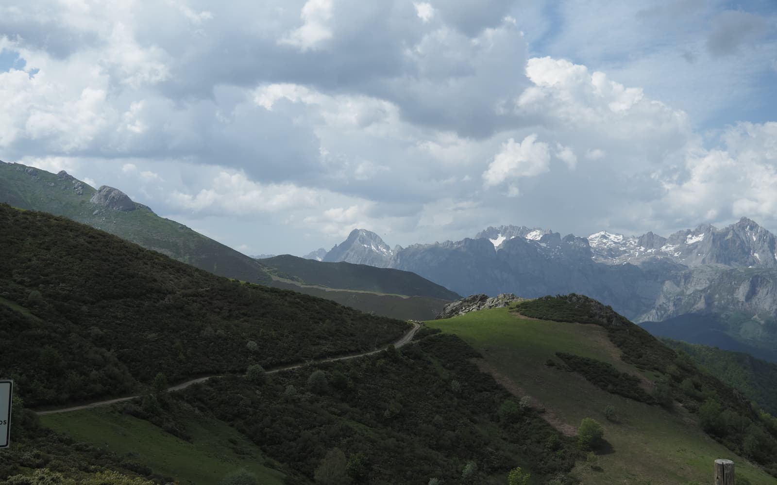
Peneda-Gerês National Park on the Geira e Arrieiros route
© José Manuel Guerrero · Fotografía propia · © Todos los derechos reservados

Braga–Santiago por el Gerês

Caminho da Geira e dos Arrieiros

The wildest route of all: cross Portugal's only National Park along a Roman road, through granite landscapes and shepherds' villages.

Historic
Distance
≈ 240 km
Days
10
Difficulty
Hard
Terrain
Mountain, Roman road and national park

Elevation profile

Ascent

+5104 m

Descent

5032 m

-12553311900 km58 km116 km174 km232 km

The Caminho da Geira e dos Arrieiros links Braga with Santiago by crossing the Peneda-Gerês National Park. Its first stretch follows the Roman Geira road (Via XVIII), while the second traces the path of the arrieiros, the muleteers who once traded with Ribadavia.

It is the wildest and least crowded of the routes, with almost untouched nature and a deep Roman heritage; it demands greater self-reliance from the pilgrim. The Cathedral of Santiago officially recognised the route for the Compostela in 2019.

Who it's for

For mountain lovers and those drawn to nature and Roman history.

The itinerary

Stages of the route

Classic division into stages. Distances are approximate and for guidance; each pilgrim adjusts their days to their own pace.

  1. 0116 km

    Cumulative: 16 km

    180288 m4 h 7 min

    Braga (Portugal)

    Braga → Santiago de Caldelas

    Leaving historic Braga behind, the trail winds through the vineyards of the Minho valley to the thermal spa town of Caldelas.

    View stage
  2. 0227 km

    Cumulative: 43 km

    1101536 m8 h 16 min

    Braga (Portugal)

    Santiago de Caldelas → Campo do Gerês

    A demanding stage that plunges into the Peneda-Gerês National Park, amid dense forests and tumbling waterfalls.

    View stage
  3. 0325 km

    Cumulative: 68 km

    524747 m6 h 50 min

    Braga · Ourense

    Campo do Gerês → Lobios

    Crossing the Portuguese-Galician border along the ancient Roman Vía Nova, all the way to the hot springs of Lobios.

    View stage
  4. 0421 km

    Cumulative: 89 km

    784259 m6 h 18 min

    Ourense · Melgaço

    Lobios → Castro Laboreiro

    A brief return into Portugal through the Xurés park, reaching the pastoral highland village of Castro Laboreiro.

    View stage
  5. 0528 km

    Cumulative: 117 km

    3281094 m7 h 13 min

    Melgaço · Ourense

    Castro Laboreiro → Cortegada

    A long mountain day that brings you back into Galicia for good, following the valley of the Salas river.

    View stage
  6. 0626 km

    Cumulative: 143 km

    351424 m6 h 47 min

    Ourense

    Cortegada → Pazos de Arenteiro

    A descent into the Ribeiro, a Galician land of vineyards and century-old wineries.

    View stage
  7. 0719 km

    Cumulative: 162 km

    885367 m6 h

    Ourense

    Pazos de Arenteiro → Beariz

    A short stage along rural lanes and old watermills, between Boborás and the uplands of Beariz.

    View stage
  8. 0832 km

    Cumulative: 194 km

    456651 m8 h 23 min

    Pontevedra

    Beariz → Codeseda

    A long day across the hills and hamlets of inland Galicia, now drawing close to A Estrada.

    View stage
  9. 0923 km

    Cumulative: 217 km

    131512 m5 h 42 min

    Pontevedra

    Codeseda → Couso (Pontevea)

    A peaceful path through the woodlands of A Estrada, edging ever nearer to the goal in Compostela.

    View stage
  10. 1016 km

    Cumulative: 233 km

    364154 m4 h 25 min

    Pontevedra · A Coruña

    Couso (Pontevea) → Santiago de Compostela

    The final day to the cathedral, bringing to a close a little-travelled and wonderfully authentic route.

    View stage

Plan your daily stages

Choose which stage you start from, how many days you have and at what pace; we split the stages into days balanced by effort (distance and elevation). You can save, share or print your plan.

Pace

10 days · ≈ 233 km in total

One or more days exceed 32 effort units (kilometres plus climb: 100 m of ascent count as 1 km). Doable if you are fit, but consider adding a day.

  1. Day 1Stage 1
    BragaSantiago de CaldelasView stage 1
    ≈ 16 km+180 m
  2. Day 2Stage 2
    Santiago de CaldelasCampo do GerêsView stage 2
    ≈ 27 km+1101 mDemanding day
  3. Day 3Stage 3
    Campo do GerêsLobiosView stage 3
    ≈ 25 km+524 m
  4. Day 4Stage 4
    LobiosCastro LaboreiroView stage 4
    ≈ 21 km+784 m
  5. Day 5Stage 5
    Castro LaboreiroCortegadaView stage 5
    ≈ 28 km+328 m
  6. Day 6Stage 6
    CortegadaPazos de ArenteiroView stage 6
    ≈ 26 km+351 m
  7. Day 7Stage 7
    Pazos de ArenteiroBearizView stage 7
    ≈ 19 km+885 m
  8. Day 8Stage 8
    BearizCodesedaView stage 8
    ≈ 32 km+456 mDemanding day
  9. Day 9Stage 9
    CodesedaCouso (Pontevea)View stage 9
    ≈ 23 km+131 m
  10. Day 10Stage 10
    Couso (Pontevea)Santiago de CompostelaView stage 10
    ≈ 16 km+364 m

An indicative split by effort (distance + elevation). It does not guarantee accommodation at each stop: check each stage and its hostels before finalising your plan.

Add stamps to your digital credential

Save this route to your account, mark each stage you complete and earn your virtual Compostela when you reach Santiago. Free.

The stamps and the digital credential are a keepsake from Santiago Plan, with no official validity: they are not the pilgrim credential and do not replace the physical stamps collected at hostels and churches to obtain the Compostela at the Cathedral.

🛡 Travel insurance for the Camino

Insurance with medical assistance, baggage cover and cancellation protects you against the unexpected: an injury, a mishap or a stage you can't walk. IATI specialises in travel and offers cover valid for the Camino de Santiago.

See IATI insurance

Affiliate link: taking it out through it costs you no more and helps keep this guide independent.

The route

The route

Approximate track of the route with the towns it passes through.

Layers

Use two fingers to move the map; Ctrl + scroll to zoom.

Download and offline navigation

Download the GPX track and open it in your hiking app (OsmAnd, Wikiloc, Locus…) to navigate without coverage.

Download GPX

Where to sleep

Accommodation and services, stage by stage

A selection of pilgrim hostels (albergues) along the Camino, ordered from the start towards Santiago. The municipal and parish ones are usually the cheapest and many cannot be booked (you arrive and check in in order). Confirm beds, price and opening times before relying on them.

2. Campo do Gerês

Santiago de Caldelas → Campo do Gerês

Hotels and guesthouses
3. Lobios

Campo do Gerês → Lobios

Hotels and guesthouses
10. Santiago de Compostela

Couso (Pontevea) → Santiago de Compostela

Hotels and guesthouses

Hostel data © OpenStreetMap contributors (ODbL). It does not include beds or price, which are not always in the source; check with the hostel. Is one missing or wrong? Write to us.

Accommodation

Hotels and guesthouses

On the Camino, pilgrim hostels (municipal, parish and private) are the cheapest option, and many cannot be booked: you arrive and check in in order of arrival. The links below search for hotels and guesthouses, for those who prefer to secure a bed in advance.

Affiliate links to Booking.com: booking through them costs you no more and helps keep this independent guide running.

When you reach Santiago

Experiences and guided tours in Santiago

When you finish your Camino, make the most of Santiago: a guided tour of the cathedral and the botafumeiro, a trip to Finisterre and Muxía (the end of the world), or the corners of the old town.

See experiences in Santiago

Affiliate link to GetYourGuide: booking through it costs you no more and helps keep this guide running.

🧭 How to get there

Find out how to travel from your city to Braga by train, bus, car or plane.

Open in Google MapsLinks to external planners; schedules and prices on their website.

Frequently asked questions

How many kilometres is the Caminho da Geira e dos Arrieiros?
The Caminho da Geira e dos Arrieiros is about 240 km and usually takes around 10 days on foot.
Is the Caminho da Geira e dos Arrieiros hard?
Its difficulty is hard. On Santiago Plan you have every stage with a map, elevation profile and hostels, so you can prepare it calmly.
How much does it cost to walk the Caminho da Geira e dos Arrieiros?
Staying in hostels, budget roughly between 250 and 450 € in total (around 10 days), including bed, food and the odd extra. It varies with the season and your travel style.
Do you need to book the hostels?
In low season it's usually not necessary, but in summer and during a Holy Year it's wise to plan ahead and, in many cases, book your accommodation. We can't guarantee bed availability.

Xacobeo 2027

Planning the Caminho da Geira e dos Arrieiros?

Leave your email and we will send you news, tips and deals to prepare this route in good time. No spam.

Other routes

See all