Santiago Plan
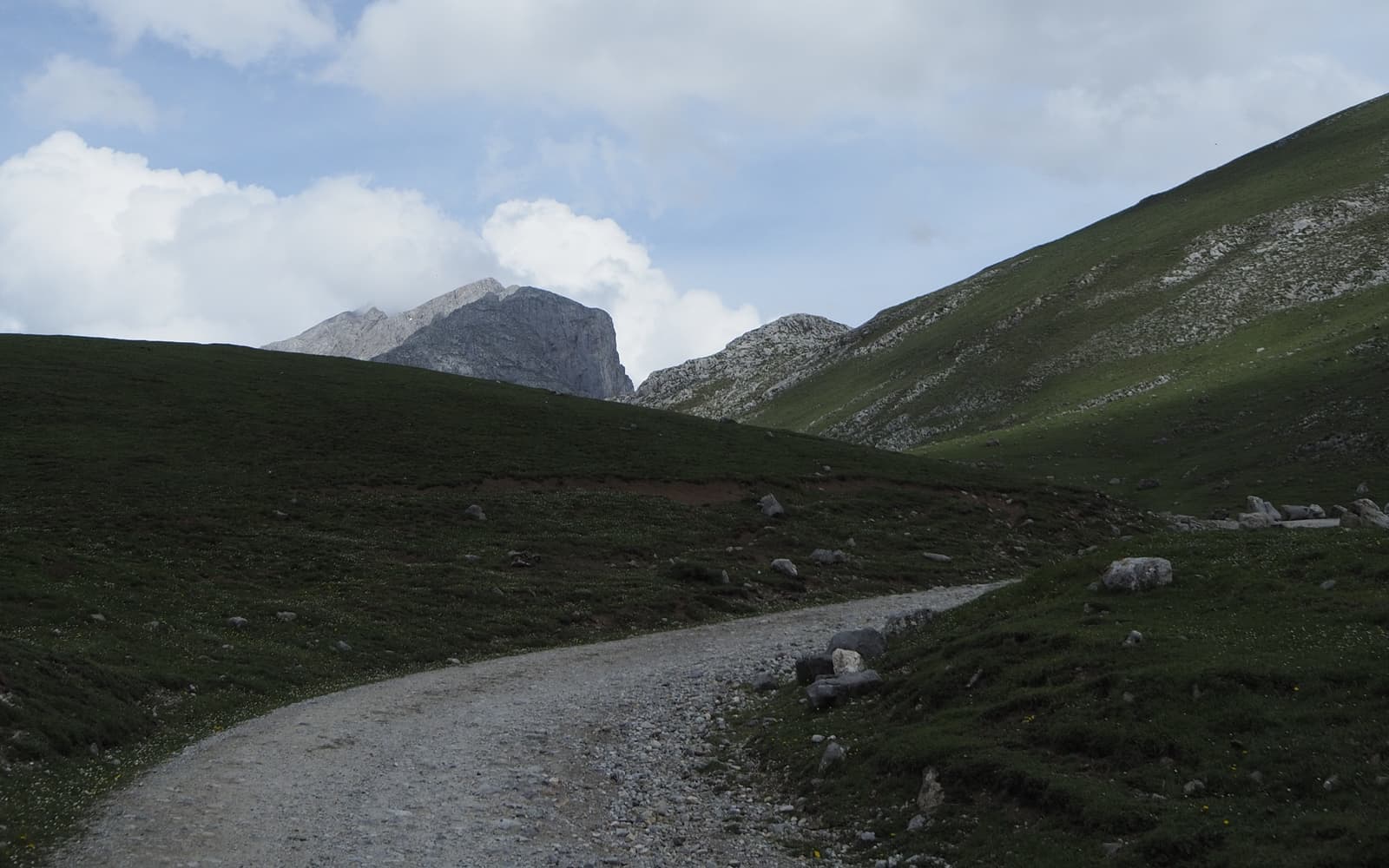
Landscape along the Camino del Norte
© José Manuel Guerrero · Fotografía propia · © Todos los derechos reservados

Camino del Norte

Along the Cantabrian coast, between sea and mountains, from Irún all the way to Santiago. Spectacular and more demanding.

✦ Historic
Distance
≈ 815 (desde Irún) km
Days
32–34
Difficulty
Hard
Terrain
Coast, mountains and a constant up and down

Elevation profile

↑ Ascent

+14715 m

↓ Descent

−14469 m

-1183858880 km191 km383 km574 km765 km

The Camino del Norte follows the Cantabrian coast through landscapes of cliffs, beaches and mountains. It is one of the most beautiful routes and also one of the most demanding, thanks to its relentless changes in elevation, with a constant up and down between the sea and the interior.

From Irún it crosses the Basque Country (San Sebastián, Bilbao), Cantabria (Santander, Santillana del Mar), Asturias (Llanes, Gijón, Avilés) and Galicia, where at Arzúa it joins the Camino Francés for the final stretch. At Villaviciosa the Camino Primitivo branches off towards Oviedo.

Who it's for

For those seeking coast and mountains who already have a few miles behind them; it calls for good physical condition.

The itinerary

Stages of the route

Classic division into stages. Distances are approximate and for guidance; each pilgrim adjusts their days to their own pace.

  1. 0118 km

    Cumulative: 18 km

    ↑239 ↓240 m⏱ 4 h 41 min

    Basque Country (Gipuzkoa)

    Irún → San Sebastián / Donostia

    Leaving Irún past the Guadalupe hermitage and over Mount Jaizkibel (or the variant through Pasaia) down to the bay of La Concha.

    View stage →
  2. 0221 km

    Cumulative: 39 km

    ↑428 ↓442 m⏱ 5 h 43 min

    Basque Country (Gipuzkoa)

    San Sebastián → Zarautz

    Through Orio and along the Gipuzkoan coast to Zarautz.

    View stage →
  3. 0320 km

    Cumulative: 59 km

    ↑679 ↓672 m⏱ 5 h 54 min

    Basque Country (Gipuzkoa)

    Zarautz → Deba

    Getaria, Zumaia and the flysch cliffs of the Basque coast on the way to Deba.

    View stage →
  4. 0418 km

    Cumulative: 77 km

    ↑759 ↓582 m⏱ 5 h 33 min

    Basque Country (Bizkaia)

    Deba → Markina-Xemein

    Inland via Olatz to Markina, now in Bizkaia.

    View stage →
  5. 0519 km

    Cumulative: 96 km

    ↑556 ↓734 m⏱ 5 h 27 min

    Basque Country (Bizkaia)

    Markina-Xemein → Gernika-Lumo

    Bolibar, the monastery of Zenarruza and Gernika, the historic Basque town.

    View stage →
  6. 0629 km

    Cumulative: 125 km

    ↑905 ↓894 m⏱ 8 h 25 min

    Basque Country (Bizkaia)

    Gernika-Lumo → Bilbao

    Over the Morga pass and into the Bilbao of the Guggenheim; a long stage.

    View stage →
  7. 0711 km

    Cumulative: 136 km

    ↑112 ↓86 m⏱ 2 h 48 min

    Basque Country (Bizkaia)

    Bilbao → Portugalete

    Following the Nervión estuary to Portugalete and its famous Hanging Bridge.

    View stage →
  8. 0826 km

    Cumulative: 162 km

    ↑642 ↓675 m⏱ 7 h 16 min

    Cantabria

    Portugalete → Castro-Urdiales

    Pobeña, the coastal path and the crossing into Cantabria as far as Castro-Urdiales.

    View stage →
  9. 0928 km

    Cumulative: 190 km

    ↑942 ↓949 m⏱ 8 h 14 min

    Cantabria

    Castro-Urdiales → Laredo

    Islares and the coastline leading to the great beach of Laredo.

    View stage →
  10. 1022 km

    Cumulative: 212 km

    ↑149 ↓102 m⏱ 5 h 29 min

    Cantabria

    Laredo → Güemes

    The boat to Santoña, then Noja and Galizano to the well-known albergue of Güemes.

    View stage →
  11. 1117 km

    Cumulative: 229 km

    ↑103 ↓148 m⏱ 4 h 13 min

    Cantabria

    Güemes → Santander

    Somo and the boat across the bay into Santander.

    View stage →
  12. 1235 km

    Cumulative: 264 km

    ↑509 ↓429 m⏱ 9 h 11 min

    Cantabria

    Santander → Santillana del Mar

    Santa Cruz de Bezana and Boo de Piélagos on the way to the medieval town of Santillana del Mar; a long stage.

    View stage →
  13. 1318 km

    Cumulative: 282 km

    ↑337 ↓387 m⏱ 4 h 51 min

    Cantabria

    Santillana del Mar → Comillas

    Cóbreces and the coast to Comillas, home to works by Gaudí.

    View stage →
  14. 1431 km

    Cumulative: 313 km

    ↑502 ↓478 m⏱ 8 h 13 min

    Cantabria · Asturias

    Comillas → Colombres

    San Vicente de la Barquera, Unquera and the crossing into Asturias.

    View stage →
  15. 1519 km

    Cumulative: 332 km

    ↑179 ↓227 m⏱ 4 h 49 min

    Asturias

    Colombres → Llanes

    The eastern Asturian coast all the way to Llanes.

    View stage →
  16. 1628 km

    Cumulative: 360 km

    ↑223 ↓224 m⏱ 7 h 2 min

    Asturias

    Llanes → Ribadesella

    Beaches and the blowholes (bufones) of Pría on the way to Ribadesella.

    View stage →
  17. 1736 km

    Cumulative: 396 km

    ↑834 ↓838 m⏱ 9 h 58 min

    Asturias

    Ribadesella → Sebrayo

    La Isla, Colunga and La Espasa as far as Sebrayo (Villaviciosa).

    View stage →
  18. 1834 km

    Cumulative: 430 km

    ↑650 ↓639 m⏱ 9 h 11 min

    Asturias

    Sebrayo → Gijón / Xixón

    At Villaviciosa the Primitivo branches off toward Oviedo; the Norte continues via Peón to Gijón.

    View stage →
  19. 1925 km

    Cumulative: 455 km

    ↑292 ↓295 m⏱ 6 h 26 min

    Asturias

    Gijón / Xixón → Avilés

    Crossing the urban outskirts of Gijón to the estuary of Avilés.

    View stage →
  20. 2021 km

    Cumulative: 476 km

    ↑451 ↓333 m⏱ 5 h 45 min

    Asturias

    Avilés → Muros de Nalón

    El Espíritu Santo and Salinas on the way to Muros de Nalón.

    View stage →
  21. 2116 km

    Cumulative: 492 km

    ↑380 ↓500 m⏱ 4 h 27 min

    Asturias

    Muros de Nalón → Soto de Luiña

    Cudillero (a short detour) and the coastal shelf to Soto de Luiña.

    View stage →
  22. 2220 km

    Cumulative: 512 km

    ↑545 ↓478 m⏱ 5 h 40 min

    Asturias

    Soto de Luiña → Cadavedo

    The Pilotos variant or the inland route to Cadavedo.

    View stage →
  23. 2315 km

    Cumulative: 527 km

    ↑228 ↓303 m⏱ 3 h 57 min

    Asturias

    Cadavedo → Luarca

    The western coast down to the white town of Luarca.

    View stage →
  24. 2430 km

    Cumulative: 557 km

    ↑415 ↓362 m⏱ 7 h 50 min

    Asturias

    Luarca → La Caridad / A Caridá

    Navia and Tapia de Casariego on the way to La Caridad.

    View stage →
  25. 2521 km

    Cumulative: 578 km

    ↑137 ↓156 m⏱ 5 h 14 min

    Asturias · Galicia

    La Caridad → Ribadeo

    Tapia and the Puente de los Santos: crossing into Galicia at Ribadeo.

    View stage →
  26. 2625 km

    Cumulative: 603 km

    ↑728 ↓632 m⏱ 7 h 10 min

    Galicia (Lugo)

    Ribadeo → Lourenzá

    Inland through the Lugo countryside to Lourenzá and its monastery.

    View stage →
  27. 2723 km

    Cumulative: 626 km

    ↑858 ↓494 m⏱ 6 h 54 min

    Galicia (Lugo)

    Lourenzá → Abadín

    Mondoñedo, with its cathedral, and the climb up to Abadín.

    View stage →
  28. 2821 km

    Cumulative: 647 km

    ↑268 ↓285 m⏱ 5 h 27 min

    Galicia (Lugo)

    Abadín → Vilalba

    Across the Terra Chá of Lugo to Vilalba.

    View stage →
  29. 2919 km

    Cumulative: 666 km

    ↑203 ↓290 m⏱ 4 h 52 min

    Galicia (Lugo)

    Vilalba → Baamonde

    Through the Galician farmland to Baamonde.

    View stage →
  30. 3040 km

    Cumulative: 706 km

    ↑650 ↓541 m⏱ 10 h 36 min

    Galicia (Lugo · A Coruña)

    Baamonde → Sobrado dos Monxes

    Miraz and the sierra up to the monastery of Sobrado dos Monxes; a long stage often split at Miraz.

    View stage →
  31. 3119 km

    Cumulative: 725 km

    ↑274 ↓385 m⏱ 4 h 59 min

    Galicia (A Coruña)

    Sobrado dos Monxes → Arzúa

    Boimorto to Arzúa, where the Norte joins the Camino Francés.

    View stage →
  32. 3221 km

    Cumulative: 746 km

    ↑239 ↓344 m⏱ 5 h 24 min

    Galicia (A Coruña)

    Arzúa → O Pedrouzo

    Now on the Francés: eucalyptus woods leading to O Pedrouzo.

    View stage →
  33. 3318 km

    Cumulative: 764 km

    ↑299 ↓325 m⏱ 4 h 47 min

    Galicia (A Coruña)

    O Pedrouzo → Santiago de Compostela

    Monte do Gozo and the arrival at the Obradoiro square.

    View stage →

Plan your daily stages

Choose which stage you start from, how many days you have and at what pace; we split the stages into days balanced by effort (distance and elevation). You can save, share or print your plan.

Pace

33 days · ≈ 764 km in total

This split is not realistic on foot: at least one day goes over 42 effort units (kilometres plus climb). Add days or start closer to Santiago (from Sarria, for instance, if you have less than a week).

  1. Day 1Stage 1
    Irún → San Sebastián / DonostiaView stage 1 ↗
    ≈ 18 km+239 m
  2. Day 2Stage 2
    San Sebastián → ZarautzView stage 2 ↗
    ≈ 21 km+428 m
  3. Day 3Stage 3
    Zarautz → DebaView stage 3 ↗
    ≈ 20 km+679 m
  4. Day 4Stage 4
    Deba → Markina-XemeinView stage 4 ↗
    ≈ 18 km+759 m
  5. Day 5Stage 5
    Markina-Xemein → Gernika-LumoView stage 5 ↗
    ≈ 19 km+556 m
  6. Day 6Stage 6
    Gernika-Lumo → BilbaoView stage 6 ↗
    ≈ 29 km+905 mDemanding day
  7. Day 7Stage 7
    Bilbao → PortugaleteView stage 7 ↗
    ≈ 11 km+112 m
  8. Day 8Stage 8
    Portugalete → Castro-UrdialesView stage 8 ↗
    ≈ 26 km+642 mDemanding day
  9. Day 9Stage 9
    Castro-Urdiales → LaredoView stage 9 ↗
    ≈ 28 km+942 mDemanding day
  10. Day 10Stage 10
    Laredo → GüemesView stage 10 ↗
    ≈ 22 km+149 m
  11. Day 11Stage 11
    Güemes → SantanderView stage 11 ↗
    ≈ 17 km+103 m
  12. Day 12Stage 12
    Santander → Santillana del MarView stage 12 ↗
    ≈ 35 km+509 mDemanding day
  13. Day 13Stage 13
    Santillana del Mar → ComillasView stage 13 ↗
    ≈ 18 km+337 m
  14. Day 14Stage 14
    Comillas → ColombresView stage 14 ↗
    ≈ 31 km+502 mDemanding day
  15. Day 15Stage 15
    Colombres → LlanesView stage 15 ↗
    ≈ 19 km+179 m
  16. Day 16Stage 16
    Llanes → RibadesellaView stage 16 ↗
    ≈ 28 km+223 m
  17. Day 17Stage 17
    Ribadesella → SebrayoView stage 17 ↗
    ≈ 36 km+834 mNot advisable
  18. Day 18Stage 18
    Sebrayo → Gijón / XixónView stage 18 ↗
    ≈ 34 km+650 mDemanding day
  19. Day 19Stage 19
    Gijón / Xixón → AvilésView stage 19 ↗
    ≈ 25 km+292 m
  20. Day 20Stage 20
    Avilés → Muros de NalónView stage 20 ↗
    ≈ 21 km+451 m
  21. Day 21Stage 21
    Muros de Nalón → Soto de LuiñaView stage 21 ↗
    ≈ 16 km+380 m
  22. Day 22Stage 22
    Soto de Luiña → CadavedoView stage 22 ↗
    ≈ 20 km+545 m
  23. Day 23Stage 23
    Cadavedo → LuarcaView stage 23 ↗
    ≈ 15 km+228 m
  24. Day 24Stage 24
    Luarca → La Caridad / A CaridáView stage 24 ↗
    ≈ 30 km+415 mDemanding day
  25. Day 25Stage 25
    La Caridad → RibadeoView stage 25 ↗
    ≈ 21 km+137 m
  26. Day 26Stage 26
    Ribadeo → LourenzáView stage 26 ↗
    ≈ 25 km+728 mDemanding day
  27. Day 27Stage 27
    Lourenzá → AbadínView stage 27 ↗
    ≈ 23 km+858 m
  28. Day 28Stage 28
    Abadín → VilalbaView stage 28 ↗
    ≈ 21 km+268 m
  29. Day 29Stage 29
    Vilalba → BaamondeView stage 29 ↗
    ≈ 19 km+203 m
  30. Day 30Stage 30
    Baamonde → Sobrado dos MonxesView stage 30 ↗
    ≈ 40 km+650 mNot advisable
  31. Day 31Stage 31
    Sobrado dos Monxes → ArzúaView stage 31 ↗
    ≈ 19 km+274 m
  32. Day 32Stage 32
    Arzúa → O PedrouzoView stage 32 ↗
    ≈ 21 km+239 m
  33. Day 33Stage 33
    O Pedrouzo → Santiago de CompostelaView stage 33 ↗
    ≈ 18 km+299 m

An indicative split by effort (distance + elevation). It does not guarantee accommodation at each stop: check each stage and its hostels before finalising your plan.

✦ Add stamps to your digital credential

Save this route to your account, mark each stage you complete and earn your virtual Compostela when you reach Santiago. Free.

The stamps and the digital credential are a keepsake from Santiago Plan, with no official validity: they are not the pilgrim credential and do not replace the physical stamps collected at hostels and churches to obtain the Compostela at the Cathedral.

🛡 Travel insurance for the Camino

Insurance with medical assistance, baggage cover and cancellation protects you against the unexpected: an injury, a mishap or a stage you can't walk. IATI specialises in travel and offers cover valid for the Camino de Santiago.

See IATI insurance ↗

Affiliate link: taking it out through it costs you no more and helps keep this guide independent.

The route

The route

Approximate track of the route with the towns it passes through.

Layers

Use two fingers to move the map; Ctrl + scroll to zoom.

Download and offline navigation

Download the GPX track and open it in your hiking app (OsmAnd, Wikiloc, Locus…) to navigate without coverage.

Download GPX

Where to sleep

Accommodation and services, stage by stage

A selection of pilgrim hostels (albergues) along the Camino, ordered from the start towards Santiago. The municipal and parish ones are usually the cheapest and many cannot be booked (you arrive and check in in order). Confirm beds, price and opening times before relying on them.

8. Castro-Urdiales

Portugalete → Castro-Urdiales

Hotels and guesthouses ↗

Hostel data © OpenStreetMap contributors (ODbL). It does not include beds or price, which are not always in the source; check with the hostel. Is one missing or wrong? Write to us.

Accommodation

Hotels and guesthouses

On the Camino, pilgrim hostels (municipal, parish and private) are the cheapest option, and many cannot be booked: you arrive and check in in order of arrival. The links below search for hotels and guesthouses, for those who prefer to secure a bed in advance.

Affiliate links to Booking.com: booking through them costs you no more and helps keep this independent guide running.

When you reach Santiago

Experiences and guided tours in Santiago

When you finish your Camino, make the most of Santiago: a guided tour of the cathedral and the botafumeiro, a trip to Finisterre and Muxía (the end of the world), or the corners of the old town.

See experiences in Santiago ↗

Affiliate link to GetYourGuide: booking through it costs you no more and helps keep this guide running.

🧭 How to get there

Find out how to travel from your city to Irún by train, bus, car or plane.

Open in Google Maps →Links to external planners; schedules and prices on their website.

Camino taxis and transfers

Companies specialising in pilgrims that cover this route: transfers between stages, luggage transport and airport.

Frequently asked questions

How many kilometres is the Camino del Norte?
The Camino del Norte is about 815 km and usually takes around 32–34 days on foot.
Is the Camino del Norte hard?
Its difficulty is hard. On Santiago Plan you have every stage with a map, elevation profile and hostels, so you can prepare it calmly.
How much does it cost to walk the Camino del Norte?
Staying in hostels, budget roughly between 800 and 1530 € in total (around 32–34 days), including bed, food and the odd extra. It varies with the season and your travel style.
Do you need to book the hostels?
In low season it's usually not necessary, but in summer and during a Holy Year it's wise to plan ahead and, in many cases, book your accommodation. We can't guarantee bed availability.

Xacobeo 2027

Planning the Camino del Norte?

Leave your email and we will send you news, tips and deals to prepare this route in good time. No spam.

Other routes

See all →