Santiago Plan
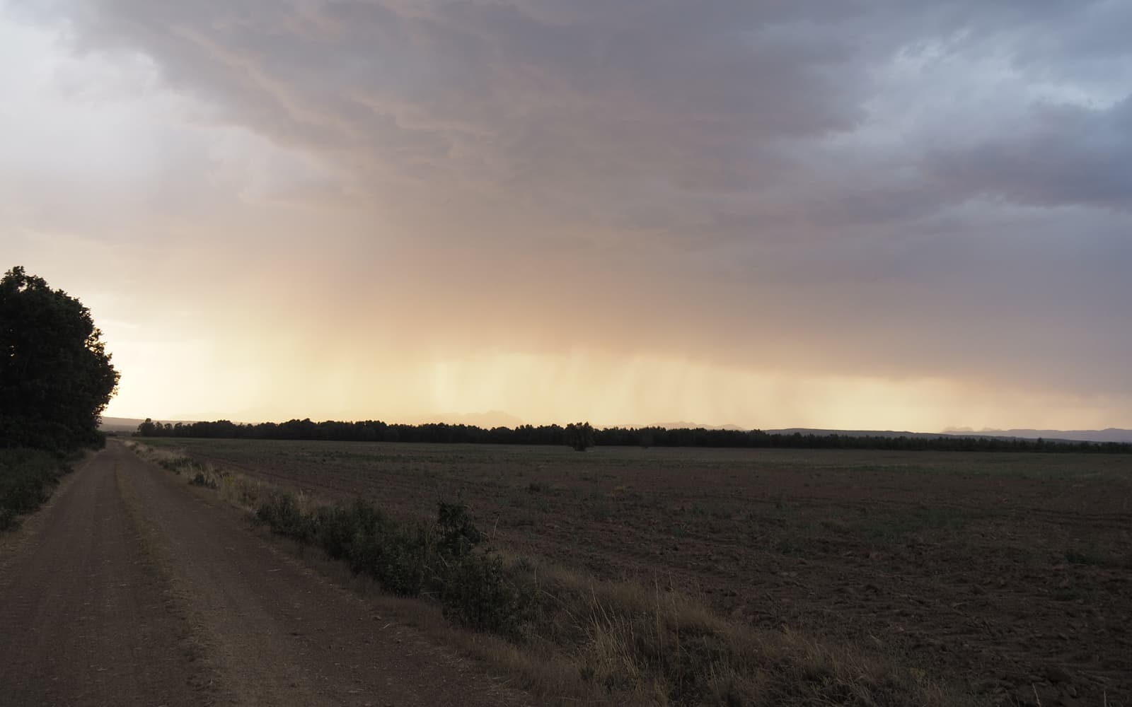
The Guadarrama mountains on the Camino de Madrid
© José Manuel Guerrero · Fotografía propia · © Todos los derechos reservados

De la capital a Sahagún

Camino de Madrid

From Madrid to Sahagún: the Guadarrama mountains, the Castilian meseta and the vineyards of Rueda, walked in solitude and free from the crowds of the Francés.

Distance
≈ 323 km
Days
13
Difficulty
Moderate
Terrain
Mountains, high plateau and cereal fields

Elevation profile

Ascent

+2379 m

Descent

2221 m

411119019680 km79 km158 km237 km316 km

The Camino de Madrid sets out from the capital, crosses the Guadarrama mountains over the Fuenfría pass and descends onto the meseta all the way to Sahagún, where it joins the Camino Francés.

An inland route, solitary and varied, with Segovia close by, the vineyards of Rueda and many peaceful villages. Its waymarking as a Jacobean route is a modern revival (1996).

Who it's for

For those leaving Madrid in search of a quiet path.

The itinerary

Stages of the route

Classic division into stages. Distances are approximate and for guidance; each pilgrim adjusts their days to their own pace.

  1. 0122 km

    Cumulative: 22 km

    189130 m5 h 33 min

    Madrid

    Madrid → Tres Cantos

    You leave the capital behind, passing El Pardo, on a gentle stretch that eases you calmly into the journey.

    View stage
  2. 0222 km

    Cumulative: 44 km

    26184 m5 h 40 min

    Madrid

    Tres Cantos → Manzanares el Real

    Views of La Pedriza and the Mendoza castle beside the Santillana reservoir.

    View stage
  3. 0317 km

    Cumulative: 61 km

    34654 m4 h 37 min

    Madrid

    Manzanares el Real → Cercedilla

    You head into the Sierra de Guadarrama, among pine forests and crisp mountain air.

    View stage
  4. 0432 km

    Cumulative: 93 km

    622834 m8 h 39 min

    Madrid · Segovia

    Cercedilla → Segovia

    You cross the Puerto de la Fuenfría (1,796 m), the highest point of all the Jacobean routes.

    View stage
  5. 0532 km

    Cumulative: 125 km

    198277 m7 h 57 min

    Segovia

    Segovia → Santa María la Real de Nieva

    You leave behind the aqueduct and the cathedral, heading out onto the Castilian plateau.

    View stage
  6. 0621 km

    Cumulative: 146 km

    34150 m5 h 3 min

    Segovia

    Santa María la Real de Nieva → Coca

    Arrival in Coca, with its imposing Mudéjar brick castle rising among the pine woods.

    View stage
  7. 0725 km

    Cumulative: 171 km

    94145 m6 h 7 min

    Segovia · Valladolid

    Coca → Alcazarén

    Pine woods and fine sand herald your entry into the lands of Valladolid.

    View stage
  8. 0824 km

    Cumulative: 195 km

    60109 m5 h 49 min

    Valladolid

    Alcazarén → Puente Duero

    You draw closer to the river Duero along quiet paths through fields of grain.

    View stage
  9. 0932 km

    Cumulative: 227 km

    22869 m8 h

    Valladolid

    Puente Duero → Peñaflor de Hornija

    A serene stage along the banks of the Duero, perfect for walking at an unhurried pace.

    View stage
  10. 1028 km

    Cumulative: 255 km

    49159 m6 h 45 min

    Valladolid

    Peñaflor de Hornija → Medina de Rioseco

    You reach the 'city of the Admirals', with its church of Santa María.

    View stage
  11. 1121 km

    Cumulative: 276 km

    9048 m5 h 9 min

    Valladolid

    Medina de Rioseco → Cuenca de Campos

    The open, silent Tierra de Campos, a fine moment for quiet reflection.

    View stage
  12. 1221 km

    Cumulative: 297 km

    11866 m5 h 12 min

    Valladolid

    Cuenca de Campos → Santervás de Campos

    A landscape of moorland and endless horizon, so typical of the northern plateau.

    View stage
  13. 1318 km

    Cumulative: 315 km

    9096 m4 h 26 min

    León

    Santervás de Campos → Sahagún

    The final stage: you reach the 'Spanish Cluny', where the Camino de Madrid joins the Camino Francés.

    View stage

Plan your daily stages

Choose which stage you start from, how many days you have and at what pace; we split the stages into days balanced by effort (distance and elevation). You can save, share or print your plan.

Pace

13 days · ≈ 315 km in total

One or more days exceed 32 effort units (kilometres plus climb: 100 m of ascent count as 1 km). Doable if you are fit, but consider adding a day.

  1. Day 1Stage 1
    MadridTres CantosView stage 1
    ≈ 22 km+189 m
  2. Day 2Stage 2
    Tres CantosManzanares el RealView stage 2
    ≈ 22 km+261 m
  3. Day 3Stage 3
    Manzanares el RealCercedillaView stage 3
    ≈ 17 km+346 m
  4. Day 4Stage 4
    CercedillaSegoviaView stage 4
    ≈ 32 km+622 mDemanding day
  5. Day 5Stage 5
    SegoviaSanta María la Real de NievaView stage 5
    ≈ 32 km+198 mDemanding day
  6. Day 6Stage 6
    Santa María la Real de NievaCocaView stage 6
    ≈ 21 km+34 m
  7. Day 7Stage 7
    CocaAlcazarénView stage 7
    ≈ 25 km+94 m
  8. Day 8Stage 8
    AlcazarénPuente DueroView stage 8
    ≈ 24 km+60 m
  9. Day 9Stage 9
    Puente DueroPeñaflor de HornijaView stage 9
    ≈ 32 km+228 mDemanding day
  10. Day 10Stage 10
    Peñaflor de HornijaMedina de RiosecoView stage 10
    ≈ 28 km+49 m
  11. Day 11Stage 11
    Medina de RiosecoCuenca de CamposView stage 11
    ≈ 21 km+90 m
  12. Day 12Stage 12
    Cuenca de CamposSantervás de CamposView stage 12
    ≈ 21 km+118 m
  13. Day 13Stage 13
    Santervás de CamposSahagúnView stage 13
    ≈ 18 km+90 m

An indicative split by effort (distance + elevation). It does not guarantee accommodation at each stop: check each stage and its hostels before finalising your plan.

Add stamps to your digital credential

Save this route to your account, mark each stage you complete and earn your virtual Compostela when you reach Santiago. Free.

The stamps and the digital credential are a keepsake from Santiago Plan, with no official validity: they are not the pilgrim credential and do not replace the physical stamps collected at hostels and churches to obtain the Compostela at the Cathedral.

🛡 Travel insurance for the Camino

Insurance with medical assistance, baggage cover and cancellation protects you against the unexpected: an injury, a mishap or a stage you can't walk. IATI specialises in travel and offers cover valid for the Camino de Santiago.

See IATI insurance

Affiliate link: taking it out through it costs you no more and helps keep this guide independent.

The route

The route

Approximate track of the route with the towns it passes through.

Layers

Use two fingers to move the map; Ctrl + scroll to zoom.

Download and offline navigation

Download the GPX track and open it in your hiking app (OsmAnd, Wikiloc, Locus…) to navigate without coverage.

Download GPX

Where to sleep

Accommodation and services, stage by stage

A selection of pilgrim hostels (albergues) along the Camino, ordered from the start towards Santiago. The municipal and parish ones are usually the cheapest and many cannot be booked (you arrive and check in in order). Confirm beds, price and opening times before relying on them.

3. Cercedilla

Manzanares el Real → Cercedilla

Hotels and guesthouses
6. Coca

Santa María la Real de Nieva → Coca

Hotels and guesthouses
9. Peñaflor de Hornija

Puente Duero → Peñaflor de Hornija

Hotels and guesthouses
10. Medina de Rioseco

Peñaflor de Hornija → Medina de Rioseco

Hotels and guesthouses
11. Cuenca de Campos

Medina de Rioseco → Cuenca de Campos

Hotels and guesthouses
12. Santervás de Campos

Cuenca de Campos → Santervás de Campos

Hotels and guesthouses
13. Sahagún

Santervás de Campos → Sahagún

Hotels and guesthouses

Hostel data © OpenStreetMap contributors (ODbL). It does not include beds or price, which are not always in the source; check with the hostel. Is one missing or wrong? Write to us.

Accommodation

Hotels and guesthouses

On the Camino, pilgrim hostels (municipal, parish and private) are the cheapest option, and many cannot be booked: you arrive and check in in order of arrival. The links below search for hotels and guesthouses, for those who prefer to secure a bed in advance.

Affiliate links to Booking.com: booking through them costs you no more and helps keep this independent guide running.

When you reach Santiago

Experiences and guided tours in Santiago

When you finish your Camino, make the most of Santiago: a guided tour of the cathedral and the botafumeiro, a trip to Finisterre and Muxía (the end of the world), or the corners of the old town.

See experiences in Santiago

Affiliate link to GetYourGuide: booking through it costs you no more and helps keep this guide running.

🧭 How to get there

Find out how to travel from your city to Madrid by train, bus, car or plane.

Open in Google MapsLinks to external planners; schedules and prices on their website.

Frequently asked questions

How many kilometres is the Camino de Madrid?
The Camino de Madrid is about 323 km and usually takes around 13 days on foot.
Is the Camino de Madrid hard?
Its difficulty is moderate. On Santiago Plan you have every stage with a map, elevation profile and hostels, so you can prepare it calmly.
How much does it cost to walk the Camino de Madrid?
Staying in hostels, budget roughly between 330 and 590 € in total (around 13 days), including bed, food and the odd extra. It varies with the season and your travel style.
Do you need to book the hostels?
In low season it's usually not necessary, but in summer and during a Holy Year it's wise to plan ahead and, in many cases, book your accommodation. We can't guarantee bed availability.

Xacobeo 2027

Planning the Camino de Madrid?

Leave your email and we will send you news, tips and deals to prepare this route in good time. No spam.

Other routes

See all