Santiago Plan
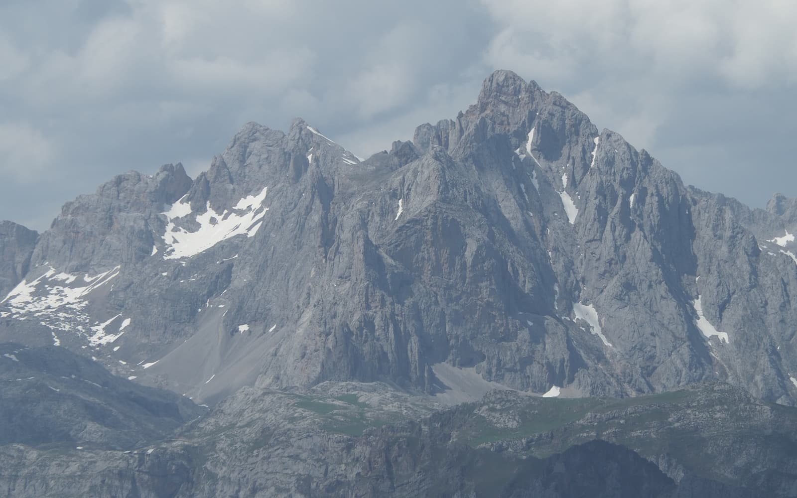
Landscape of the Camino Aragonés
© José Manuel Guerrero · Fotografía propia · © Todos los derechos reservados

Por el Somport

Camino Aragonés

The continuation of the Via Tolosana: from Somport to Puente la Reina, short, solitary and steeped in the character of the Alto Aragón.

Historic
Distance
≈ 165 km
Days
6–7
Difficulty
Moderate
Terrain
Pyrenees, valleys of the Alto Aragón and open plain

Elevation profile

Ascent

+4573 m

Descent

5849 m

21146429070 km51 km102 km152 km203 km

The Camino Aragonés drops down from the Somport pass to Puente la Reina, where it joins the Camino Francés. It is the natural continuation of the Via Tolosana, one of the four great medieval routes of the Codex Calixtinus.

Short but with a character all its own and far more solitary than the Francés, it crosses Jaca, San Juan de la Peña and the valleys of the Alto Aragón.

Who it's for

For those crossing the eastern Pyrenees in search of calm.

The itinerary

Stages of the route

Classic division into stages. Distances are approximate and for guidance; each pilgrim adjusts their days to their own pace.

  1. 0151 km

    Cumulative: 51 km

    22263031 m15 h 51 min

    Huesca (Aragon)

    Somport → Jaca

    A descent from the Pyrenees through Canfranc and Villanúa down to historic Jaca and its Romanesque cathedral.

    View stage
  2. 0235 km

    Cumulative: 86 km

    383541 m8 h 58 min

    Huesca (Aragon)

    Jaca → Arrés

    Crossing the Canal de Berdún with views of the Mallos de Riglos and the Pyrenees.

    View stage
  3. 0329 km

    Cumulative: 115 km

    750436 m8 h 9 min

    Huesca · Zaragoza

    Arrés → Ruesta

    A solitary stage through woodland toward the abandoned village and Templar castle of Ruesta, beside Yesa.

    View stage
  4. 0424 km

    Cumulative: 139 km

    195725 m6 h 2 min

    Zaragoza · Navarre

    Ruesta → Sangüesa

    Entering Navarre along the Yesa reservoir to reach the noble medieval town of Sangüesa.

    View stage
  5. 0532 km

    Cumulative: 171 km

    578472 m8 h 35 min

    Navarre

    Sangüesa → Monreal

    A path through cereal fields, crossing the Lumbier gorge on the way to Monreal.

    View stage
  6. 0632 km

    Cumulative: 203 km

    441644 m8 h 21 min

    Navarre

    Monreal → Puente la Reina

    The final stage, crossing the Sierra del Perdón to join the Camino Francés.

    View stage

Plan your daily stages

Choose which stage you start from, how many days you have and at what pace; we split the stages into days balanced by effort (distance and elevation). You can save, share or print your plan.

Pace

6 days · ≈ 203 km in total

This split is not realistic on foot: at least one day goes over 42 effort units (kilometres plus climb). Add days or start closer to Santiago (from Sarria, for instance, if you have less than a week).

  1. Day 1Stage 1
    SomportJacaView stage 1
    ≈ 51 km+2226 mNot advisable
  2. Day 2Stage 2
    JacaArrésView stage 2
    ≈ 35 km+383 mDemanding day
  3. Day 3Stage 3
    ArrésRuestaView stage 3
    ≈ 29 km+750 mDemanding day
  4. Day 4Stage 4
    RuestaSangüesaView stage 4
    ≈ 24 km+195 m
  5. Day 5Stage 5
    SangüesaMonrealView stage 5
    ≈ 32 km+578 mDemanding day
  6. Day 6Stage 6
    MonrealPuente la ReinaView stage 6
    ≈ 32 km+441 mDemanding day

An indicative split by effort (distance + elevation). It does not guarantee accommodation at each stop: check each stage and its hostels before finalising your plan.

Add stamps to your digital credential

Save this route to your account, mark each stage you complete and earn your virtual Compostela when you reach Santiago. Free.

The stamps and the digital credential are a keepsake from Santiago Plan, with no official validity: they are not the pilgrim credential and do not replace the physical stamps collected at hostels and churches to obtain the Compostela at the Cathedral.

🛡 Travel insurance for the Camino

Insurance with medical assistance, baggage cover and cancellation protects you against the unexpected: an injury, a mishap or a stage you can't walk. IATI specialises in travel and offers cover valid for the Camino de Santiago.

See IATI insurance

Affiliate link: taking it out through it costs you no more and helps keep this guide independent.

The route

The route

Approximate track of the route with the towns it passes through.

Layers

Use two fingers to move the map; Ctrl + scroll to zoom.

Download and offline navigation

Download the GPX track and open it in your hiking app (OsmAnd, Wikiloc, Locus…) to navigate without coverage.

Download GPX

Where to sleep

Accommodation and services, stage by stage

A selection of pilgrim hostels (albergues) along the Camino, ordered from the start towards Santiago. The municipal and parish ones are usually the cheapest and many cannot be booked (you arrive and check in in order). Confirm beds, price and opening times before relying on them.

Hostel data © OpenStreetMap contributors (ODbL). It does not include beds or price, which are not always in the source; check with the hostel. Is one missing or wrong? Write to us.

Accommodation

Hotels and guesthouses

On the Camino, pilgrim hostels (municipal, parish and private) are the cheapest option, and many cannot be booked: you arrive and check in in order of arrival. The links below search for hotels and guesthouses, for those who prefer to secure a bed in advance.

Affiliate links to Booking.com: booking through them costs you no more and helps keep this independent guide running.

When you reach Santiago

Experiences and guided tours in Santiago

When you finish your Camino, make the most of Santiago: a guided tour of the cathedral and the botafumeiro, a trip to Finisterre and Muxía (the end of the world), or the corners of the old town.

See experiences in Santiago

Affiliate link to GetYourGuide: booking through it costs you no more and helps keep this guide running.

🧭 How to get there

Find out how to travel from your city to Somport by train, bus, car or plane.

Open in Google MapsLinks to external planners; schedules and prices on their website.

Camino taxis and transfers

Companies specialising in pilgrims that cover this route: transfers between stages, luggage transport and airport.

  • Antzin Mochileros - Transportes📞 +34 629 434 214Website

    Aragonés completo: Somport/Canfranc–Jaca–Sangüesa–Monreal–Puente la Reina

    • passengers
    • luggage
    • bikes
    • groups

Frequently asked questions

How many kilometres is the Camino Aragonés?
The Camino Aragonés is about 165 km and usually takes around 6–7 days on foot.
Is the Camino Aragonés hard?
Its difficulty is moderate. On Santiago Plan you have every stage with a map, elevation profile and hostels, so you can prepare it calmly.
How much does it cost to walk the Camino Aragonés?
Staying in hostels, budget roughly between 150 and 320 € in total (around 6–7 days), including bed, food and the odd extra. It varies with the season and your travel style.
Do you need to book the hostels?
In low season it's usually not necessary, but in summer and during a Holy Year it's wise to plan ahead and, in many cases, book your accommodation. We can't guarantee bed availability.

Xacobeo 2027

Planning the Camino Aragonés?

Leave your email and we will send you news, tips and deals to prepare this route in good time. No spam.

Other routes

See all