Santiago Plan
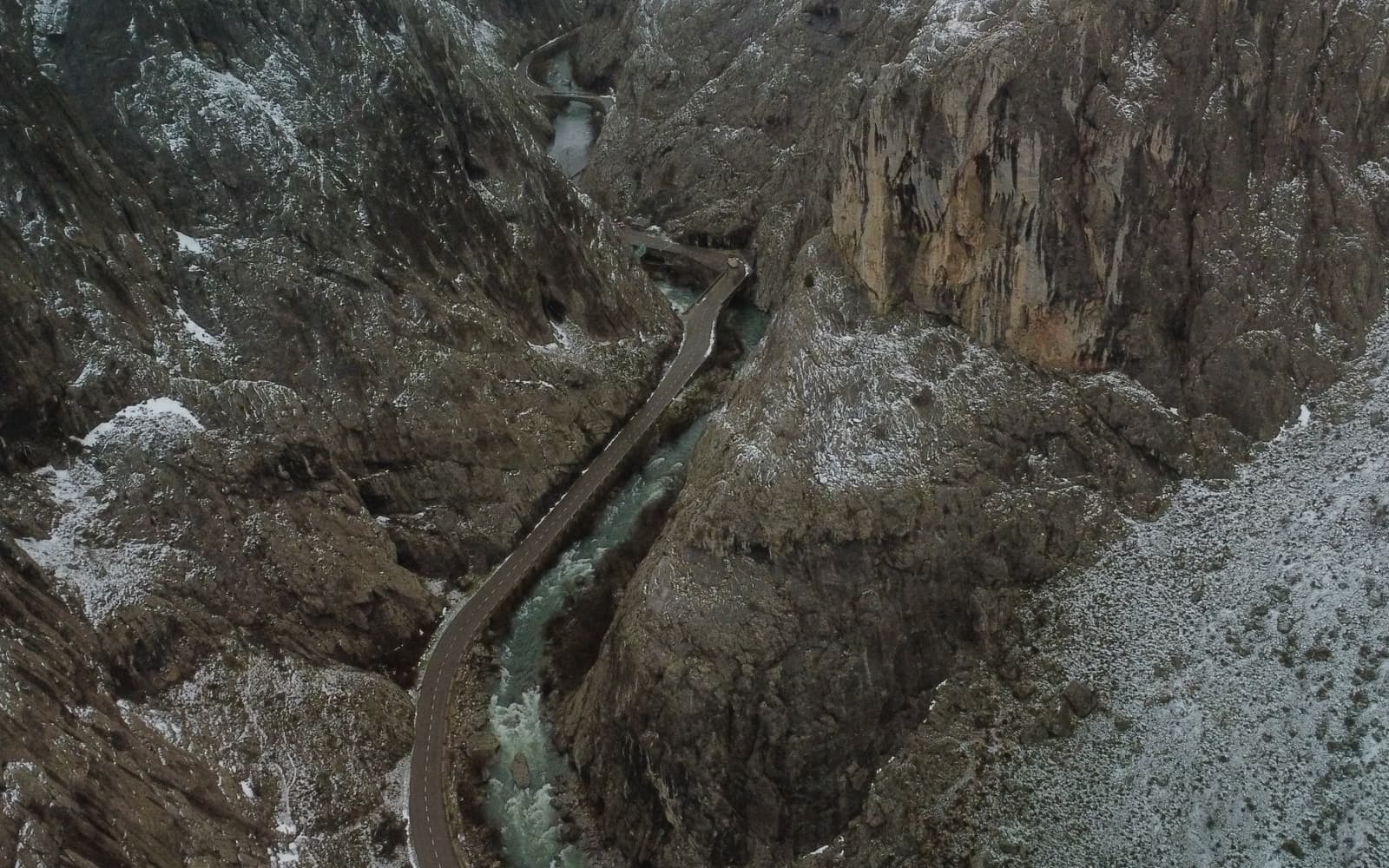
Droving trails of the Camino de la Lana
© José Manuel Guerrero · Fotografía propia · © Todos los derechos reservados

Por Cuenca hasta Burgos

Camino de la Lana

Ancient wool droving trails from Alicante or Valencia to Burgos, by way of Cuenca: deeply solitary, for the self-sufficient walker.

Distance
≈ 676 (desde Alicante) km
Days
27
Difficulty
Moderate
Terrain
Drovers' trails, dirt tracks and high plateau

Elevation profile

Ascent

+8319 m

Descent

7467 m

-18369715760 km165 km330 km494 km659 km

The Camino de la Lana follows old cattle-droving routes and the wool-trade roads (16th–17th centuries) from Alicante or Valencia up to Burgos, passing through Cuenca, where it joins the Camino Francés.

Very solitary and almost without pilgrim infrastructure, it is a route for the self-sufficient walker in search of an itinerary steeped in pastoral history.

Who it's for

For the independent walker seeking solitude and open country.

The itinerary

Stages of the route

Classic division into stages. Distances are approximate and for guidance; each pilgrim adjusts their days to their own pace.

  1. 0121 km

    Cumulative: 21 km

    447203 m5 h 45 min

    Alicante

    Alicante → Orito

    You leave the Mediterranean coast for the interior, crossing the dry hills of Alicante.

    View stage
  2. 0219 km

    Cumulative: 40 km

    444241 m5 h 16 min

    Alicante

    Orito → Petrer

    A short stage through the Vinalopó region, among vineyards and almond groves.

    View stage
  3. 0322 km

    Cumulative: 62 km

    219169 m5 h 36 min

    Alicante

    Petrer → Villena

    You reach Villena, with its castle and the celebrated Visigothic treasure.

    View stage
  4. 0414 km

    Cumulative: 76 km

    7033 m3 h 27 min

    Alicante · Albacete

    Villena → Caudete

    A short stage crossing into Castilla-La Mancha, a land of vineyards and fine wine.

    View stage
  5. 0525 km

    Cumulative: 101 km

    411268 m6 h 38 min

    Albacete

    Caudete → Almansa

    You arrive in Almansa, its castle perched on a crag overlooking the town.

    View stage
  6. 0622 km

    Cumulative: 123 km

    278118 m5 h 42 min

    Albacete

    Almansa → Alpera

    A calm Manchegan landscape of pine woods and cereal fields.

    View stage
  7. 0723 km

    Cumulative: 146 km

    287293 m5 h 57 min

    Albacete

    Alpera → Alatoz

    A solitary stage across the Manchegan plateau, seldom walked by pilgrims.

    View stage
  8. 0828 km

    Cumulative: 174 km

    251393 m7 h 5 min

    Albacete

    Alatoz → Casas Ibáñez

    A long day among the vineyards of the Manchuela in Albacete.

    View stage
  9. 0926 km

    Cumulative: 200 km

    14592 m6 h 26 min

    Albacete · Cuenca

    Casas Ibáñez → Villarta

    A quiet stage on the way to the province of Cuenca.

    View stage
  10. 1029 km

    Cumulative: 229 km

    335176 m7 h 28 min

    Cuenca

    Villarta → Campillo de Altobuey

    The lonely landscape of the Manchuela of Cuenca, very little travelled.

    View stage
  11. 1128 km

    Cumulative: 257 km

    285212 m7 h 8 min

    Cuenca

    Campillo de Altobuey → Monteagudo de las Salinas

    A long day through unpopulated country, typical of this little-known route.

    View stage
  12. 1223 km

    Cumulative: 280 km

    255238 m5 h 54 min

    Cuenca

    Monteagudo de las Salinas → Fuentes

    You draw near to the city of Cuenca through peaceful scenery.

    View stage
  13. 1319 km

    Cumulative: 299 km

    150213 m4 h 46 min

    Cuenca

    Fuentes → Cuenca

    Arrival in Cuenca, with its famous Hanging Houses above the Huécar gorge.

    View stage
  14. 1424 km

    Cumulative: 323 km

    394275 m6 h 22 min

    Cuenca

    Cuenca → Bascuñana de San Pedro

    You leave Cuenca for the highlands, the Huécar gorge behind you.

    View stage
  15. 1527 km

    Cumulative: 350 km

    153396 m6 h 41 min

    Cuenca

    Bascuñana de San Pedro → Villaconejos de Trabaque

    A solitary stage among pine woods, with a warm welcome at the final hostel.

    View stage
  16. 1627 km

    Cumulative: 377 km

    327311 m6 h 58 min

    Cuenca · Guadalajara

    Villaconejos de Trabaque → Salmerón

    You cross the river Guadiela, the boundary between Cuenca and Guadalajara.

    View stage
  17. 1720 km

    Cumulative: 397 km

    445398 m5 h 30 min

    Guadalajara

    Salmerón → Viana de Mondéjar

    A quiet stage through the Alcarria, a land of honey and gentle scenery.

    View stage
  18. 1823 km

    Cumulative: 420 km

    390364 m6 h 8 min

    Guadalajara

    Viana de Mondéjar → Cifuentes

    You reach Cifuentes, with its Templar castle above the town.

    View stage
  19. 1928 km

    Cumulative: 448 km

    353384 m7 h 15 min

    Guadalajara

    Cifuentes → Mandayona

    You join the GR-10 before crossing a plateau towards Mandayona.

    View stage
  20. 2036 km

    Cumulative: 484 km

    584279 m9 h 33 min

    Guadalajara

    Mandayona → Atienza

    A long and lovely stage ending in the historic medieval town of Atienza.

    View stage
  21. 2120 km

    Cumulative: 504 km

    437384 m5 h 29 min

    Guadalajara · Soria

    Atienza → Retortillo de Soria

    You reach the Alto de la Carrascosa, the highest point of the entire Camino de la Lana.

    View stage
  22. 2223 km

    Cumulative: 527 km

    211481 m5 h 50 min

    Soria

    Retortillo de Soria → Fresno de Caracena

    A quiet Sorian stage, closely following the route of El Cid.

    View stage
  23. 2321 km

    Cumulative: 548 km

    87167 m5 h 9 min

    Soria

    Fresno de Caracena → San Esteban de Gormaz

    You approach the Sorian Duero valley, with San Esteban a key Jacobean landmark.

    View stage
  24. 2430 km

    Cumulative: 578 km

    345284 m7 h 43 min

    Soria · Burgos

    San Esteban de Gormaz → Quintanarraya

    A long day crossing tributaries of the Duero before entering Burgos.

    View stage
  25. 2524 km

    Cumulative: 602 km

    433361 m6 h 26 min

    Burgos

    Quintanarraya → Santo Domingo de Silos

    You reach the celebrated Benedictine monastery of Santo Domingo de Silos.

    View stage
  26. 2623 km

    Cumulative: 625 km

    400420 m6 h 9 min

    Burgos

    Santo Domingo de Silos → Mecerreyes

    You cross the Majadal and the river Arlanza on the way to Mecerreyes.

    View stage
  27. 2733 km

    Cumulative: 658 km

    183314 m8 h 10 min

    Burgos

    Mecerreyes → Burgos

    Final stage: you arrive in Burgos, where the Camino de la Lana joins the French Way.

    View stage

Plan your daily stages

Choose which stage you start from, how many days you have and at what pace; we split the stages into days balanced by effort (distance and elevation). You can save, share or print your plan.

Pace

27 days · ≈ 658 km in total

One or more days exceed 32 effort units (kilometres plus climb: 100 m of ascent count as 1 km). Doable if you are fit, but consider adding a day.

  1. Day 1Stage 1
    AlicanteOritoView stage 1
    ≈ 21 km+447 m
  2. Day 2Stage 2
    OritoPetrerView stage 2
    ≈ 19 km+444 m
  3. Day 3Stage 3
    PetrerVillenaView stage 3
    ≈ 22 km+219 m
  4. Day 4Stage 4
    VillenaCaudeteView stage 4
    ≈ 14 km+70 m
  5. Day 5Stage 5
    CaudeteAlmansaView stage 5
    ≈ 25 km+411 m
  6. Day 6Stage 6
    AlmansaAlperaView stage 6
    ≈ 22 km+278 m
  7. Day 7Stage 7
    AlperaAlatozView stage 7
    ≈ 23 km+287 m
  8. Day 8Stage 8
    AlatozCasas IbáñezView stage 8
    ≈ 28 km+251 m
  9. Day 9Stage 9
    Casas IbáñezVillartaView stage 9
    ≈ 26 km+145 m
  10. Day 10Stage 10
    VillartaCampillo de AltobueyView stage 10
    ≈ 29 km+335 mDemanding day
  11. Day 11Stage 11
    Campillo de AltobueyMonteagudo de las SalinasView stage 11
    ≈ 28 km+285 m
  12. Day 12Stage 12
    Monteagudo de las SalinasFuentesView stage 12
    ≈ 23 km+255 m
  13. Day 13Stage 13
    FuentesCuencaView stage 13
    ≈ 19 km+150 m
  14. Day 14Stage 14
    CuencaBascuñana de San PedroView stage 14
    ≈ 24 km+394 m
  15. Day 15Stage 15
    Bascuñana de San PedroVillaconejos de TrabaqueView stage 15
    ≈ 27 km+153 m
  16. Day 16Stage 16
    Villaconejos de TrabaqueSalmerónView stage 16
    ≈ 27 km+327 m
  17. Day 17Stage 17
    SalmerónViana de MondéjarView stage 17
    ≈ 20 km+445 m
  18. Day 18Stage 18
    Viana de MondéjarCifuentesView stage 18
    ≈ 23 km+390 m
  19. Day 19Stage 19
    CifuentesMandayonaView stage 19
    ≈ 28 km+353 m
  20. Day 20Stage 20
    MandayonaAtienzaView stage 20
    ≈ 36 km+584 mDemanding day
  21. Day 21Stage 21
    AtienzaRetortillo de SoriaView stage 21
    ≈ 20 km+437 m
  22. Day 22Stage 22
    Retortillo de SoriaFresno de CaracenaView stage 22
    ≈ 23 km+211 m
  23. Day 23Stage 23
    Fresno de CaracenaSan Esteban de GormazView stage 23
    ≈ 21 km+87 m
  24. Day 24Stage 24
    San Esteban de GormazQuintanarrayaView stage 24
    ≈ 30 km+345 mDemanding day
  25. Day 25Stage 25
    QuintanarrayaSanto Domingo de SilosView stage 25
    ≈ 24 km+433 m
  26. Day 26Stage 26
    Santo Domingo de SilosMecerreyesView stage 26
    ≈ 23 km+400 m
  27. Day 27Stage 27
    MecerreyesBurgosView stage 27
    ≈ 33 km+183 mDemanding day

An indicative split by effort (distance + elevation). It does not guarantee accommodation at each stop: check each stage and its hostels before finalising your plan.

Add stamps to your digital credential

Save this route to your account, mark each stage you complete and earn your virtual Compostela when you reach Santiago. Free.

The stamps and the digital credential are a keepsake from Santiago Plan, with no official validity: they are not the pilgrim credential and do not replace the physical stamps collected at hostels and churches to obtain the Compostela at the Cathedral.

🛡 Travel insurance for the Camino

Insurance with medical assistance, baggage cover and cancellation protects you against the unexpected: an injury, a mishap or a stage you can't walk. IATI specialises in travel and offers cover valid for the Camino de Santiago.

See IATI insurance

Affiliate link: taking it out through it costs you no more and helps keep this guide independent.

The route

The route

Approximate track of the route with the towns it passes through.

Layers

Use two fingers to move the map; Ctrl + scroll to zoom.

Download and offline navigation

Download the GPX track and open it in your hiking app (OsmAnd, Wikiloc, Locus…) to navigate without coverage.

Download GPX

Where to sleep

Accommodation and services, stage by stage

A selection of pilgrim hostels (albergues) along the Camino, ordered from the start towards Santiago. The municipal and parish ones are usually the cheapest and many cannot be booked (you arrive and check in in order). Confirm beds, price and opening times before relying on them.

15. Villaconejos de Trabaque

Bascuñana de San Pedro → Villaconejos de Trabaque

Hotels and guesthouses
23. San Esteban de Gormaz

Fresno de Caracena → San Esteban de Gormaz

Hotels and guesthouses
26. Mecerreyes

Santo Domingo de Silos → Mecerreyes

Hotels and guesthouses

Hostel data © OpenStreetMap contributors (ODbL). It does not include beds or price, which are not always in the source; check with the hostel. Is one missing or wrong? Write to us.

Accommodation

Hotels and guesthouses

On the Camino, pilgrim hostels (municipal, parish and private) are the cheapest option, and many cannot be booked: you arrive and check in in order of arrival. The links below search for hotels and guesthouses, for those who prefer to secure a bed in advance.

Affiliate links to Booking.com: booking through them costs you no more and helps keep this independent guide running.

When you reach Santiago

Experiences and guided tours in Santiago

When you finish your Camino, make the most of Santiago: a guided tour of the cathedral and the botafumeiro, a trip to Finisterre and Muxía (the end of the world), or the corners of the old town.

See experiences in Santiago

Affiliate link to GetYourGuide: booking through it costs you no more and helps keep this guide running.

🧭 How to get there

Find out how to travel from your city to Alicante by train, bus, car or plane.

Open in Google MapsLinks to external planners; schedules and prices on their website.

Frequently asked questions

How many kilometres is the Camino de la Lana?
The Camino de la Lana is about 676 km and usually takes around 27 days on foot.
Is the Camino de la Lana hard?
Its difficulty is moderate. On Santiago Plan you have every stage with a map, elevation profile and hostels, so you can prepare it calmly.
How much does it cost to walk the Camino de la Lana?
Staying in hostels, budget roughly between 680 and 1220 € in total (around 27 days), including bed, food and the odd extra. It varies with the season and your travel style.
Do you need to book the hostels?
In low season it's usually not necessary, but in summer and during a Holy Year it's wise to plan ahead and, in many cases, book your accommodation. We can't guarantee bed availability.

Xacobeo 2027

Planning the Camino de la Lana?

Leave your email and we will send you news, tips and deals to prepare this route in good time. No spam.

Other routes

See all